Things to Know About Custom Map Layers
- Boundary Features can be defined using county lines, free drawn, or through providing a file matching our import specs Creating Custom Map Layers: Area Boundaries (Bulk Upload)
- Point Features can be defined using addresses, or latitude/longitude coordinates through our UI or by providing a file matching our import specs Creating Custom Map Layers: Location Points (Bulk Upload)
- Layers can only contain entirely boundaries or points; you cannot mix two different types of features
- When a boundary layer is toggled on, all boundary features will be highlighted on the map
- Reports can be generated based on the boundaries of a feature
- Attributes can be added to every feature layer. Examples of attributes could be the name of the region manager, internal reference codes, etc.
Custom Map Layer Terms to Know
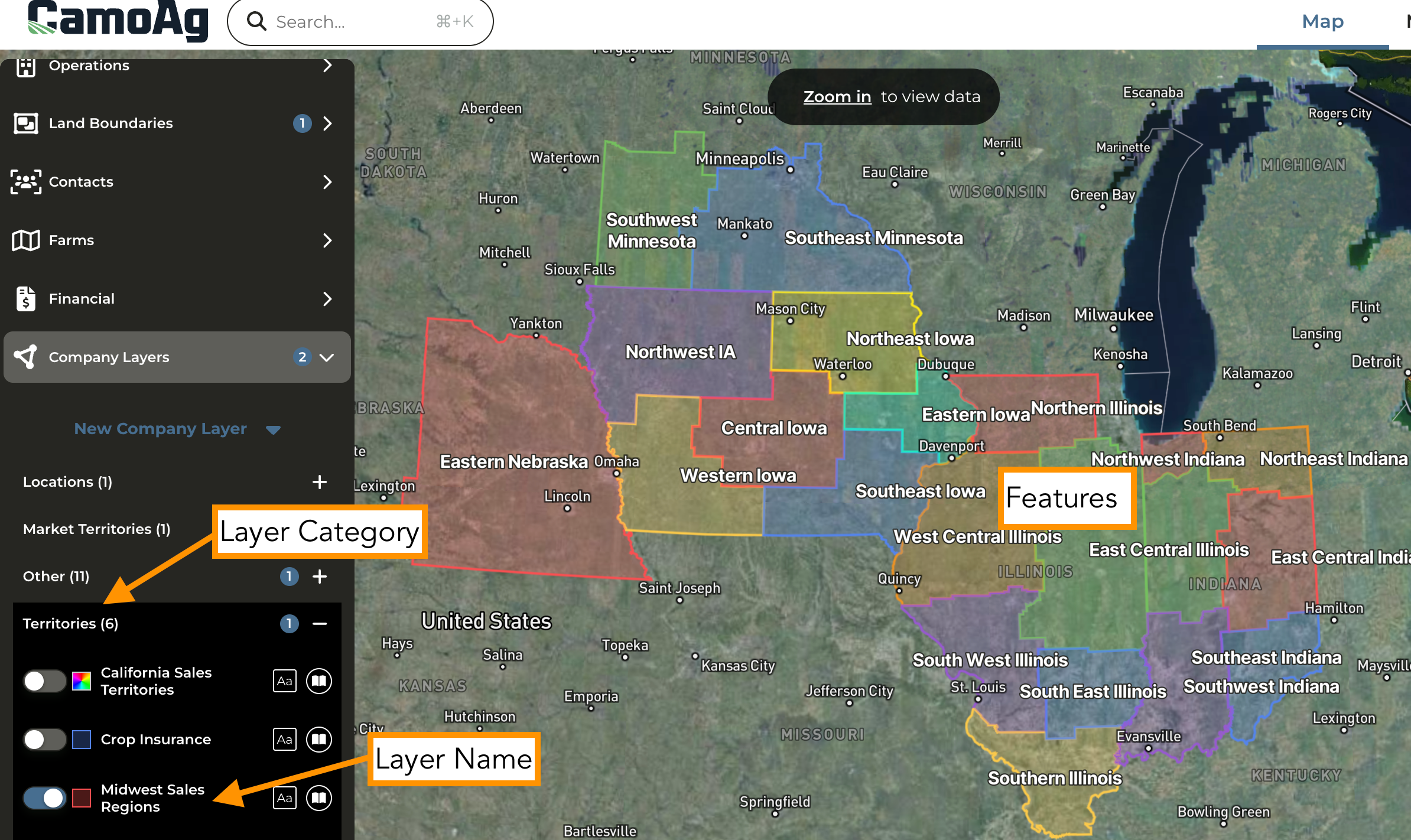
- Layer Category: Think of this as how you will categorize your layers
- Layer Name: Assign a more defined name for the map layer. The Layer Name can be toggled on or off on the map.
- Features: Layer features is where you actually define the boundaries and further define the feature. When you enable a Layer Name, all Features added to that Layer Name will appear on the map.
- Attributes: Optional field that allows you to add attributes to each feature layer. For example, you may want to include an attribute titled “Region Leader” and define who is responsible for each area defined.