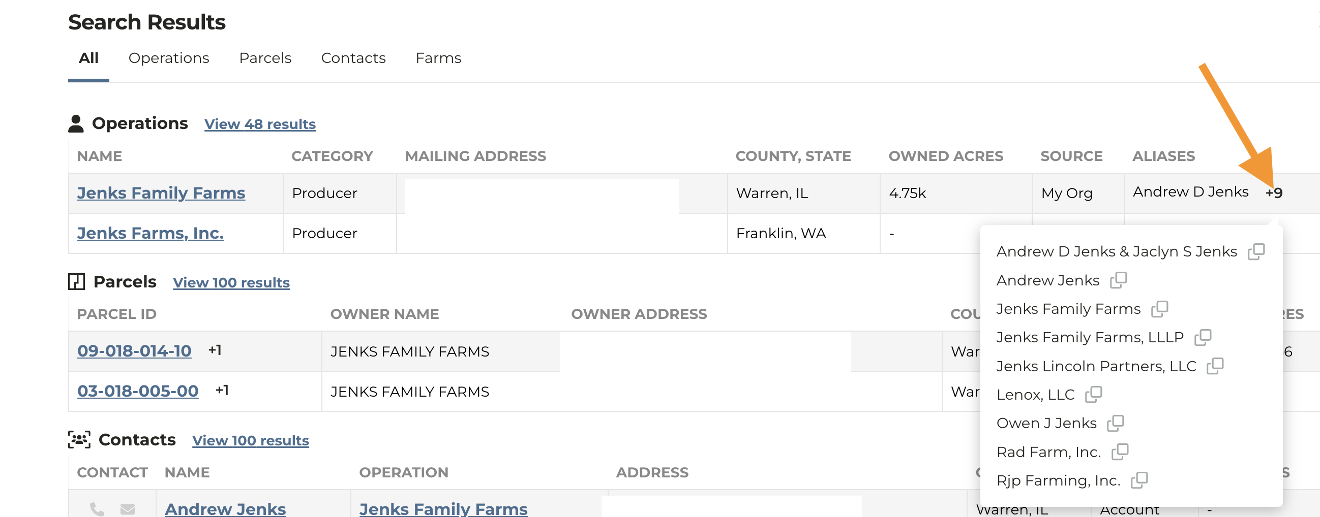
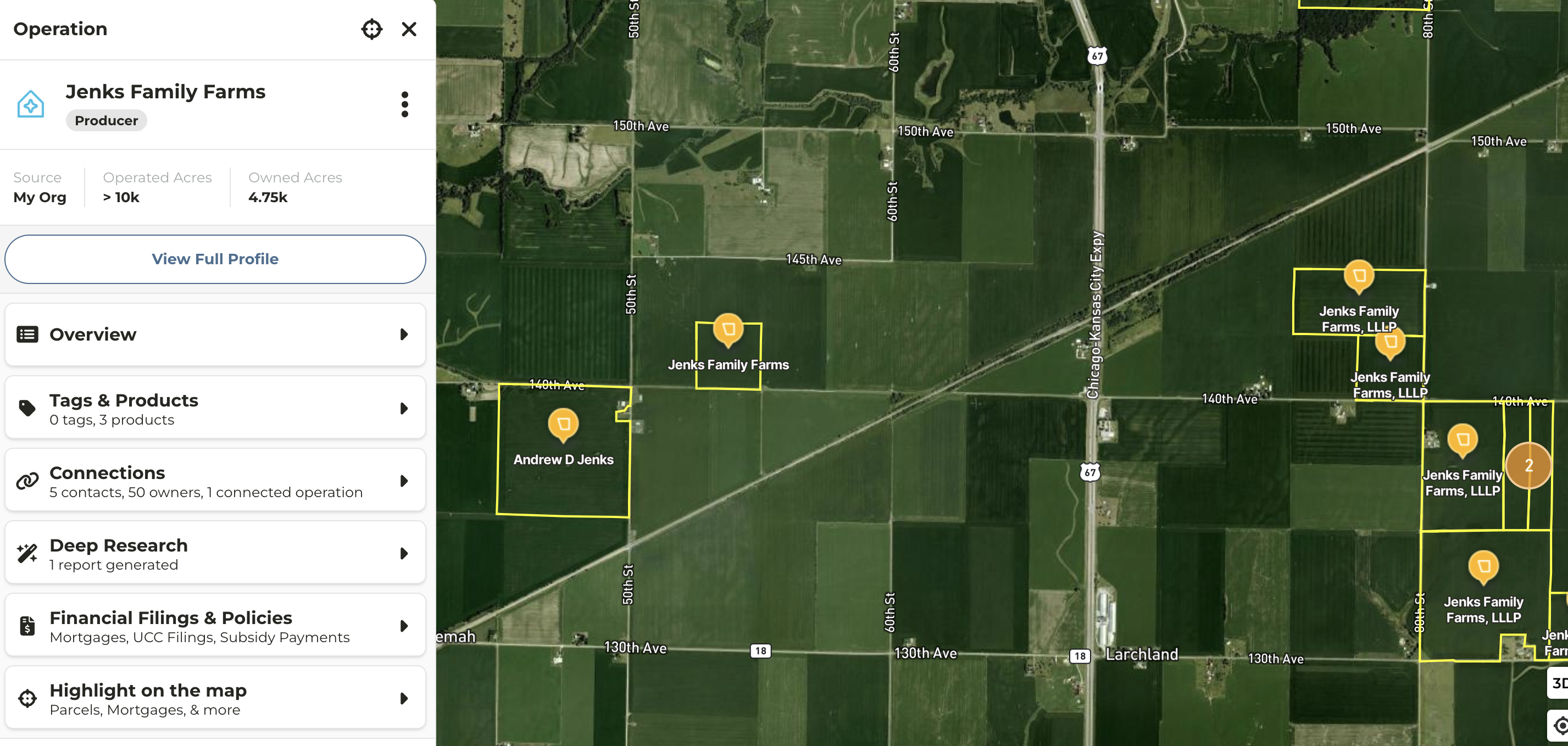
Parcel Owner Name Display
- Owner entity name now displays on a parcel on the map if you navigate to the map from the search results
- In cases where an Operation has multiple aliases or owner entities, this enhancement allows you see see which parcels is associated with which entity
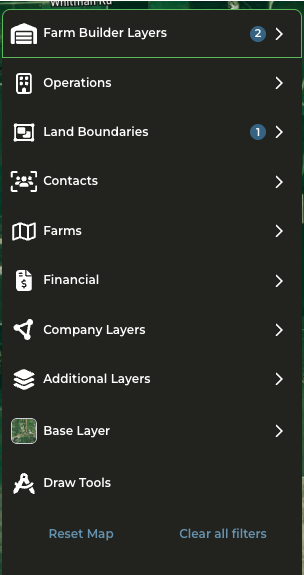
New Map Layer Navigation
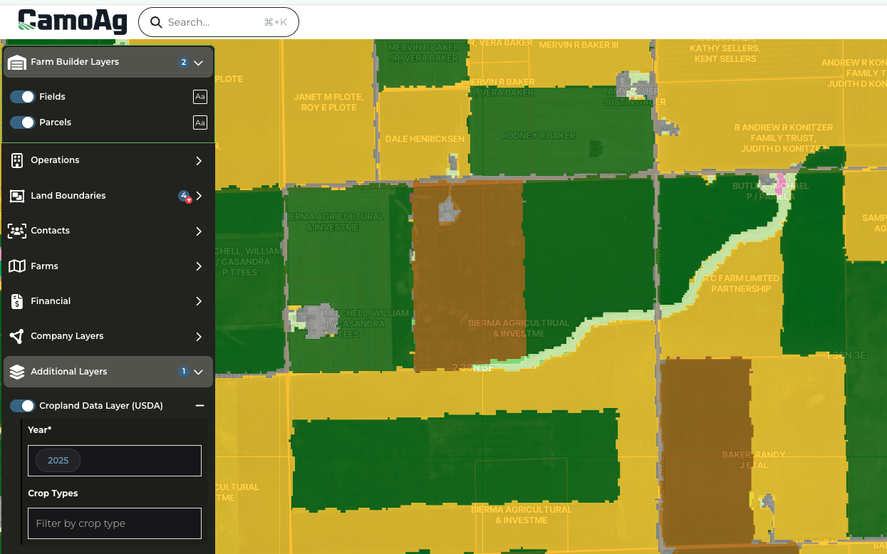
Crop Data Layer Available on Map
- Enable the Crop Data Layer within Additional Layers
- Filter by specific year and crop type to target specific parcels on the map
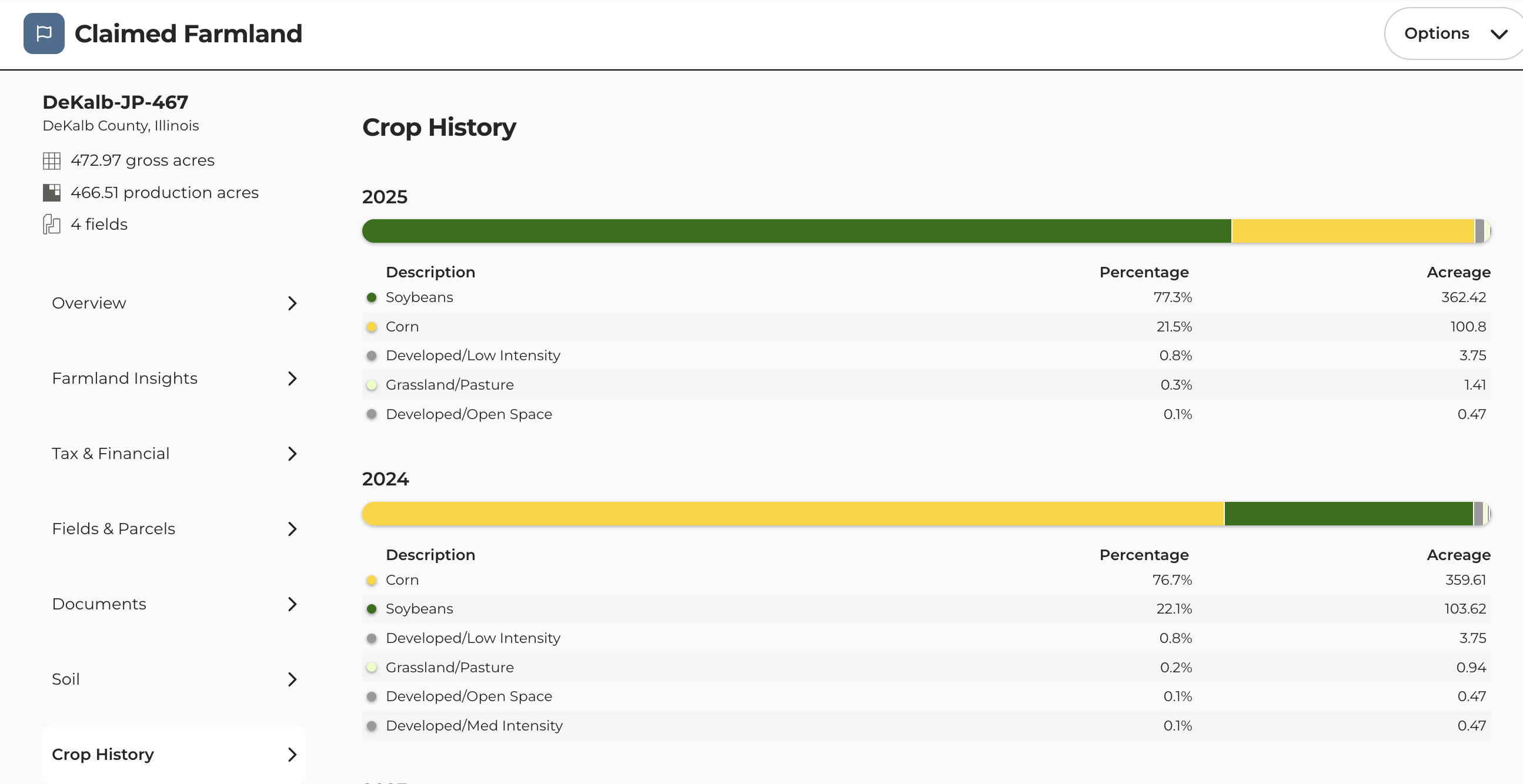
2025 Crop Data Uploaded
- 2025 Crop History data is now available
Last modified on May 22, 2026