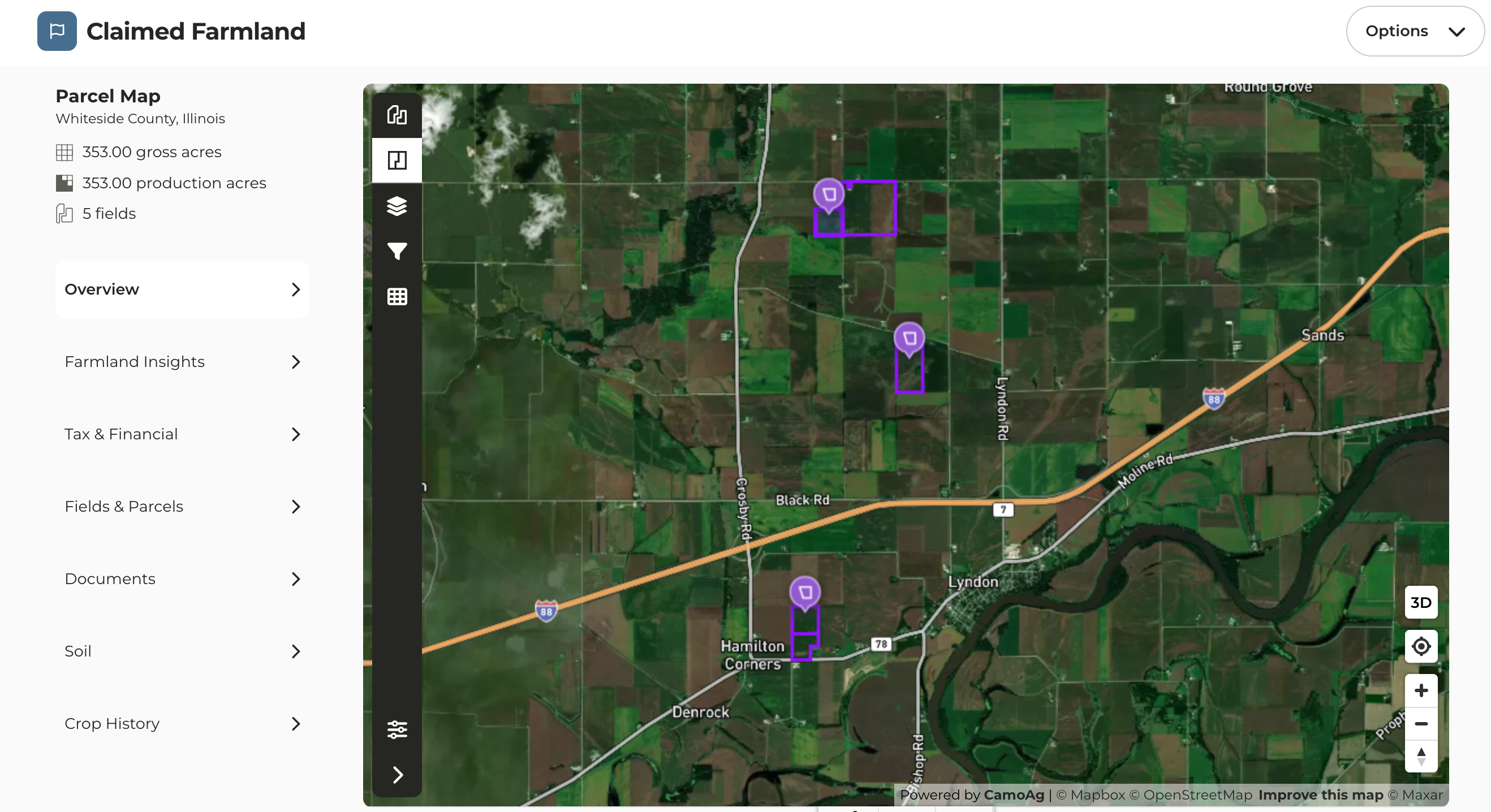
Farm Overview Map Enhancement
- On the map view of a claimed farm, additional icons have been added to call attention to the location of the parcels
- In instances where you may have parcels in different locations, this quickly calls attention to those parcels on the map
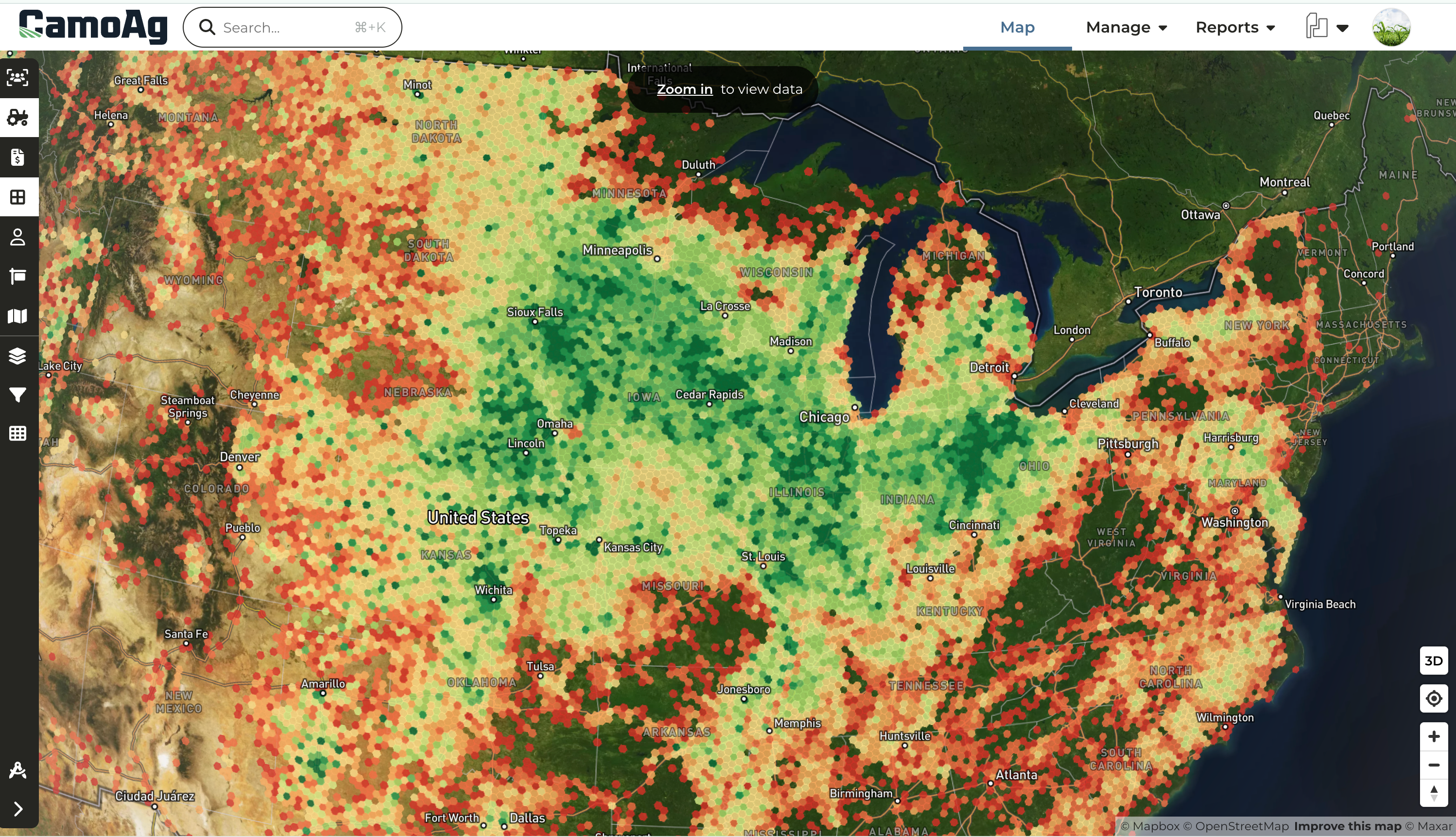
CamoAg Producer Data Layer
*Available to Customers with a Pro or Enterprise Subscription
- CamoAg has identified producers and bucketed them by size using publicly available subsidy payment data. Based on the amount of payments received in 2021, we’ve been able to determine operation sizes. It is important to note that payments cap out at a certain amount so the larger the operation, the more challenging it is to determine the operation size
- Zoom out to see producer density
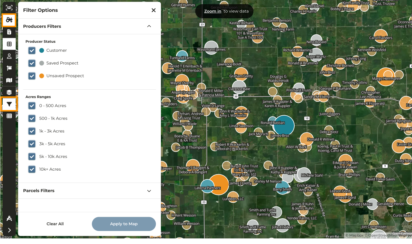
- Zoom in to the map to see producers matched to their addresses
- Click on the icon to view information about that producer
- Enable the Filters and filter the map to display only producers within certain acre ranges
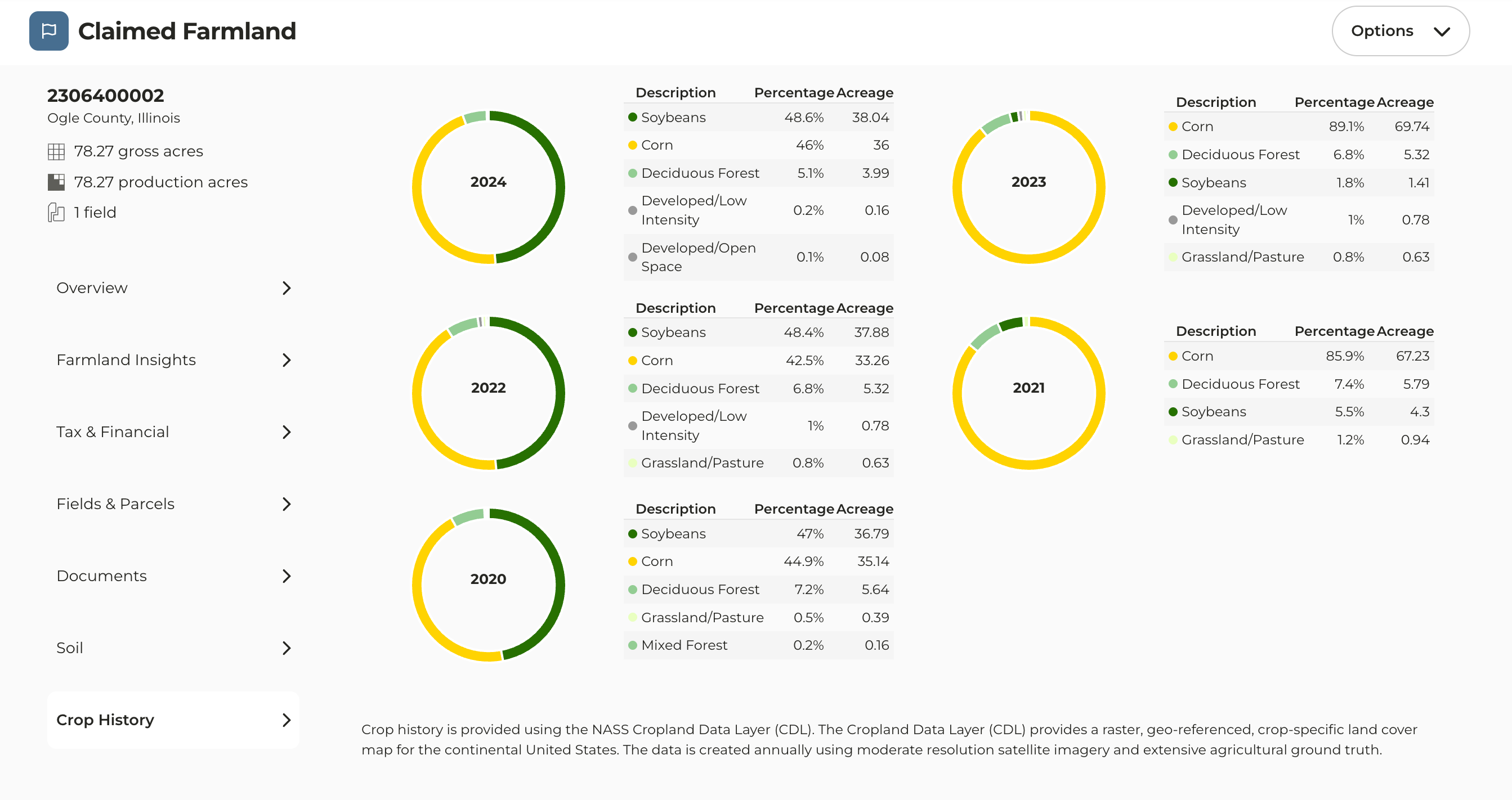
2024 Crop Data
- 2024 Crop History is now available for properties added to your account
- Please note the crop history available on the parcel panel on the map is provided by Regrid and as a result we are waiting for them to update their data
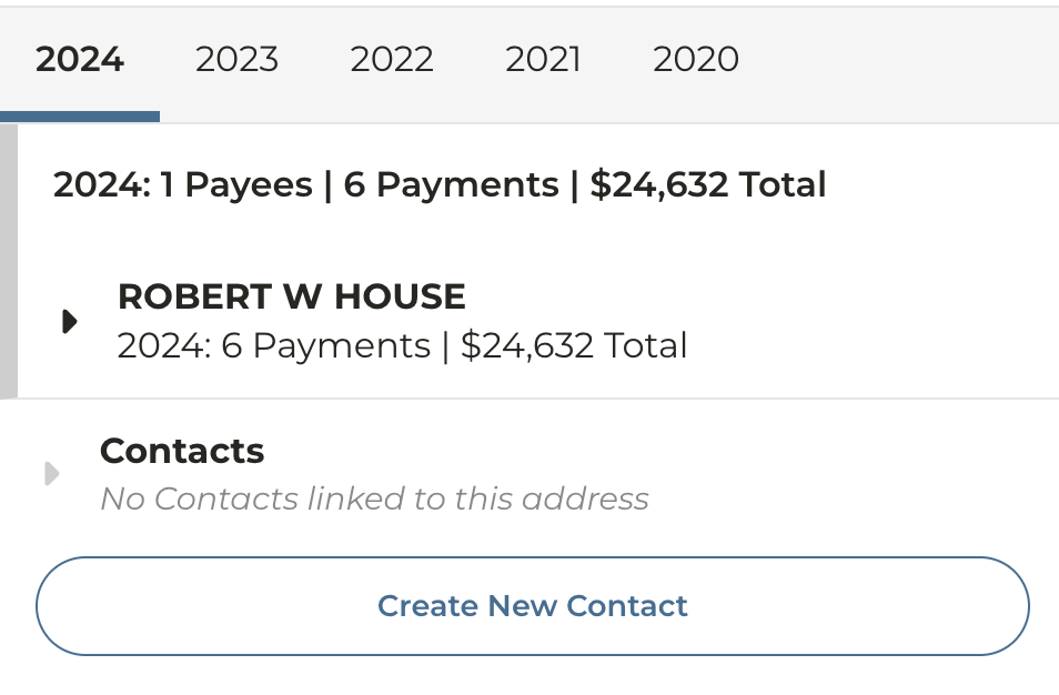
2024 Subsidy Payment Data
- 2024 Subsidy payment data has been uploaded and is now available on the USDA Subsidies report as well as within the Owner information panel on the map
- Payment data is based on the year the payment was received and not necessarily the crop year
Last modified on May 22, 2026