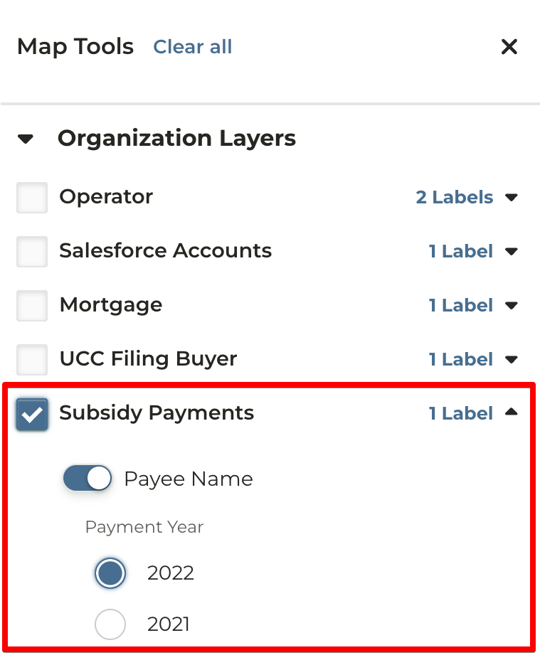
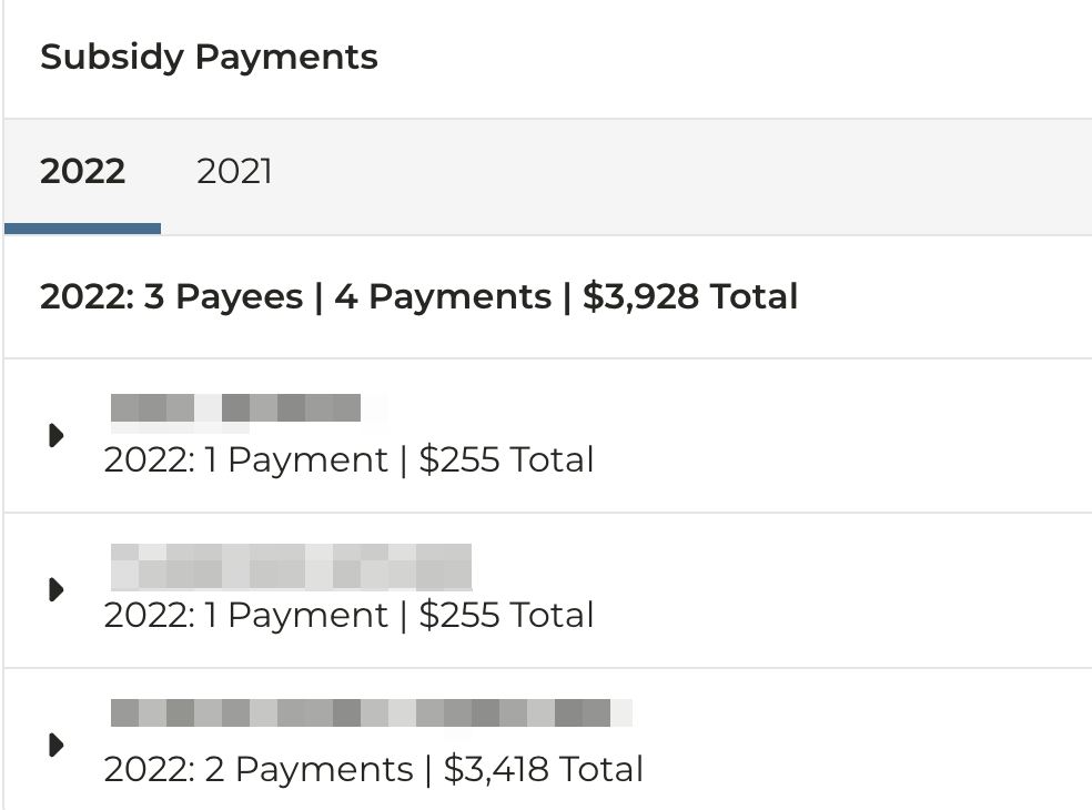
2022 Subsidy Payment Data
*released to all users with a CamoAg Basic or Pro subscription
2022 Subsidy payment data is now available. This data is updated annually after it is released by the USDA. You can view subsidy data on the maps by viewing connected information for an operator or by enabling the subsidy data layer.
CLU SmartDraw
*released to all users (released week of 2.23.2024)
The CLU SmartDraw provides the ability to more easily draw out a farm by using CLU data provided by the FSA. The tool takes any CLU boundaries within the parcels you select and creates fields with the appropriate tillable or non-tillable acreage types from Crop Data Layer information. View the guide here!
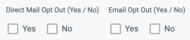
Direct Mail/Email Opt In/Out filters for reports
*released to users with a Salesforce integration subscription (released week of 2.23.2024)
Filters for Direct Mail and Email Opt Out have been added to the Operators, Owners, Salesforce Accounts, Mortgages, and UCC reports. This will help users identify those who opt out of specific contact. These data fields come directly from an organization’s Salesforce integration and need to be added as part of the setup.
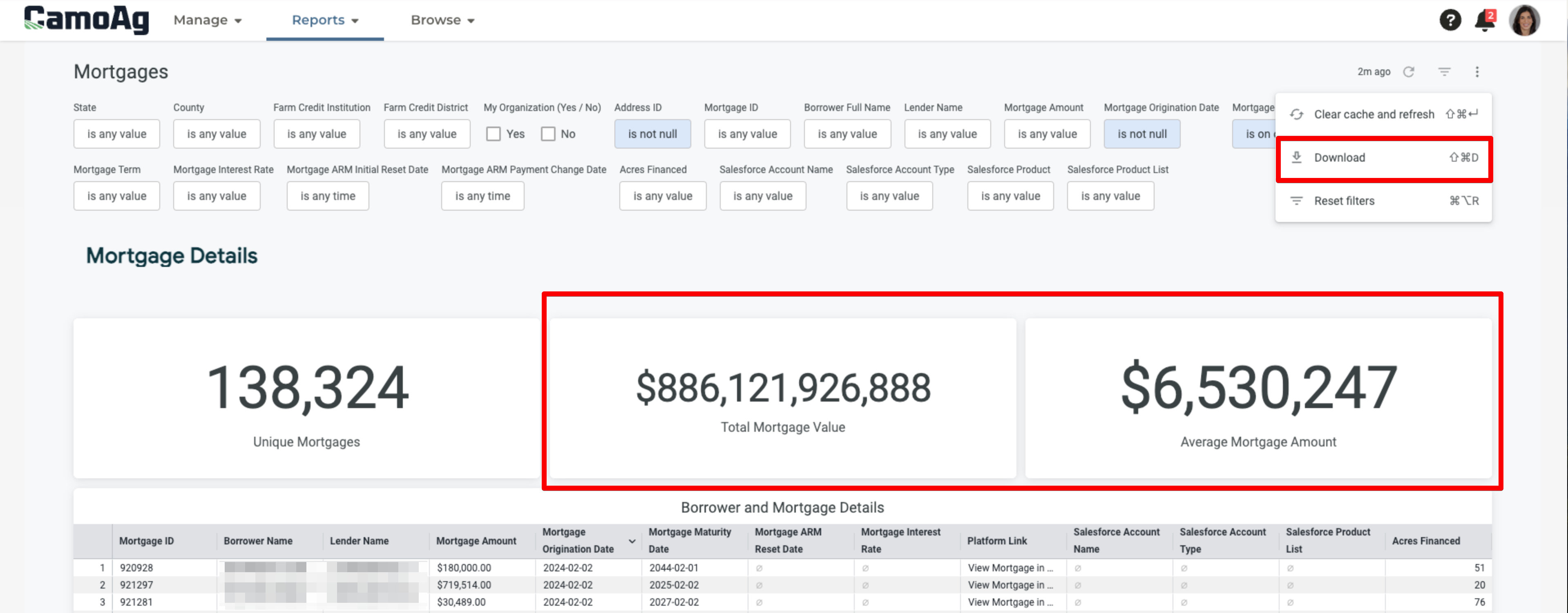
Revamped Mortgages Dashboard
*released to all users with a mortgage data subscription (released week of 2.16.2024)
Updates to our Mortgages Dashboard including an added total mortgage value and average mortgage amount. We have also deduped the direct mail list so the report is now immediately downloadable to be sent directly to a printer.
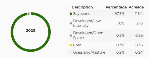
USDA 2023 Cropland Data Layer
*released to all users (released week of 2.16.2024)
2023 Cropland Data Layer released by the USDA is now available for all 50 States.
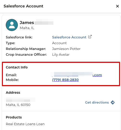
Contact information for Salesforce Accounts
*released to users with a Salesforce integration (released week of 2.9.2024)
Email and phone numbers (mobile, home and business) will now display for Salesforce Accounts
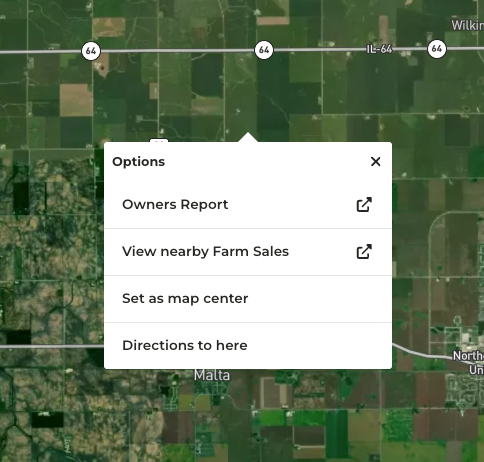
Right-click functionality on maps
*released to all users with limited options based on feature (released week of 2.9.2024)
On any map, users can right-click (or tap-and-hold on mobile) to bring up a limited menu of options, one of which is new - opening the Owners Report set to a radius based on the point selected. View the guide here. The following options have been added to the right-click menu:
- Owners Report (only with a CamoAg Pro subscription)
- View nearby Farm Sales
- Set as map center
- Directions to here
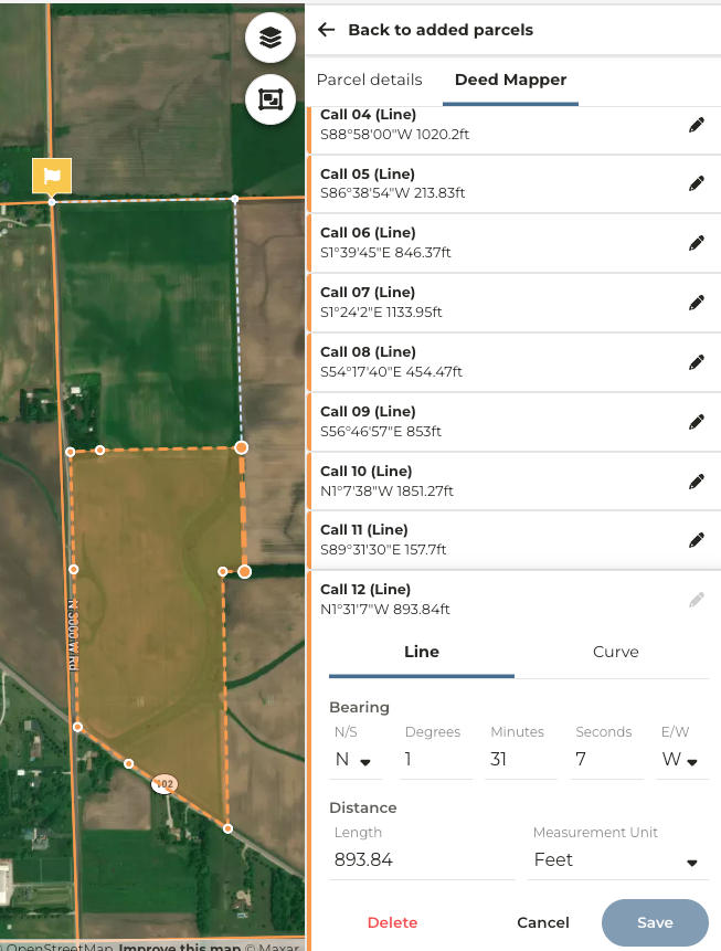
Deed Mapper for creating farm boundaries from legal description
*available to a beta testing group. soon to be a part of the CamoAg Basic or Pro subscriptions (released week of 2.2.2024)
The CamoAg Deed Mapper will allow users to create farm boundaries from legal survey descriptions. This provides the ability to have more accurate boundaries of farms that precisely match the legal boundaries. Users can enter starting points, select the point of beginning, enter calls, as well as exceptions and curves.
Last modified on May 22, 2026