> ## Documentation Index
> Fetch the complete documentation index at: https://docs.camo.ag/llms.txt
> Use this file to discover all available pages before exploring further.
# Using the Map Tools
#### **Map Tools Reference**
**Draw Polygon**
* Use this tool to manually define a field or parcel boundary, or to exclude an obstructed or non-productive area from the productive acreage calculation
* Click [Using the Draw Polygon Tool](/hc/en-us/articles/23973220859287-Using-the-Draw-Polygon-Tool) for detailed instructions
**Merge**
* Can be used to merge one or more parcels or fields
* Combines adjacent parcels or fields into a single boundary
* Merging parcels will disable the county assessor convenience link
* Click [Merging Fields or Parcels](https://youtu.be/B62EAexFZ9I) to view a quick demonstration
**Cut**
* Must click on the parcel or field first to make this option available
* Divides a field into multiple fields, subdivides a parcel, or isolates acreage along a field border.
* Click [Using the Cut Tool](/hc/en-us/articles/26589948400151-Using-the-Cut-Tool) for detailed instructions
**Simplify**
* Reduces the number of points on a boundary\*.\*
| **Before** | \*\* After\*\* |
| :------------------------------------------------------------------------------------------------------------------------------------------------------- | :------------------------------------------------------------------------------------------------------------------------------------------------------- |
| 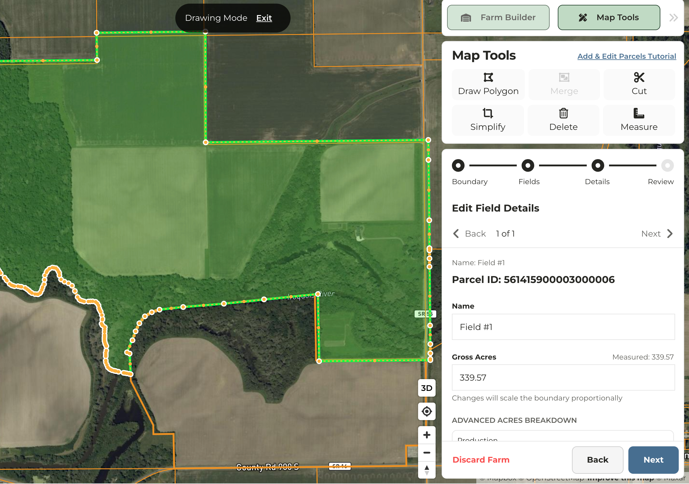 |
| 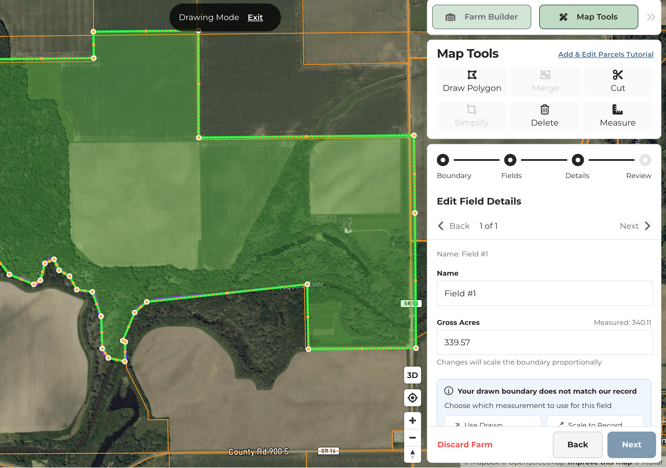 |
**Delete**
* Removes a selected field or parcel.
**Measure**
* Measures the distance between points in feet, yards, miles, meters, or kilometers.
* Multiple points can be dropped and distance will be measured between each point and totaled
* Measurements can be copied and pasted but will not be saved.
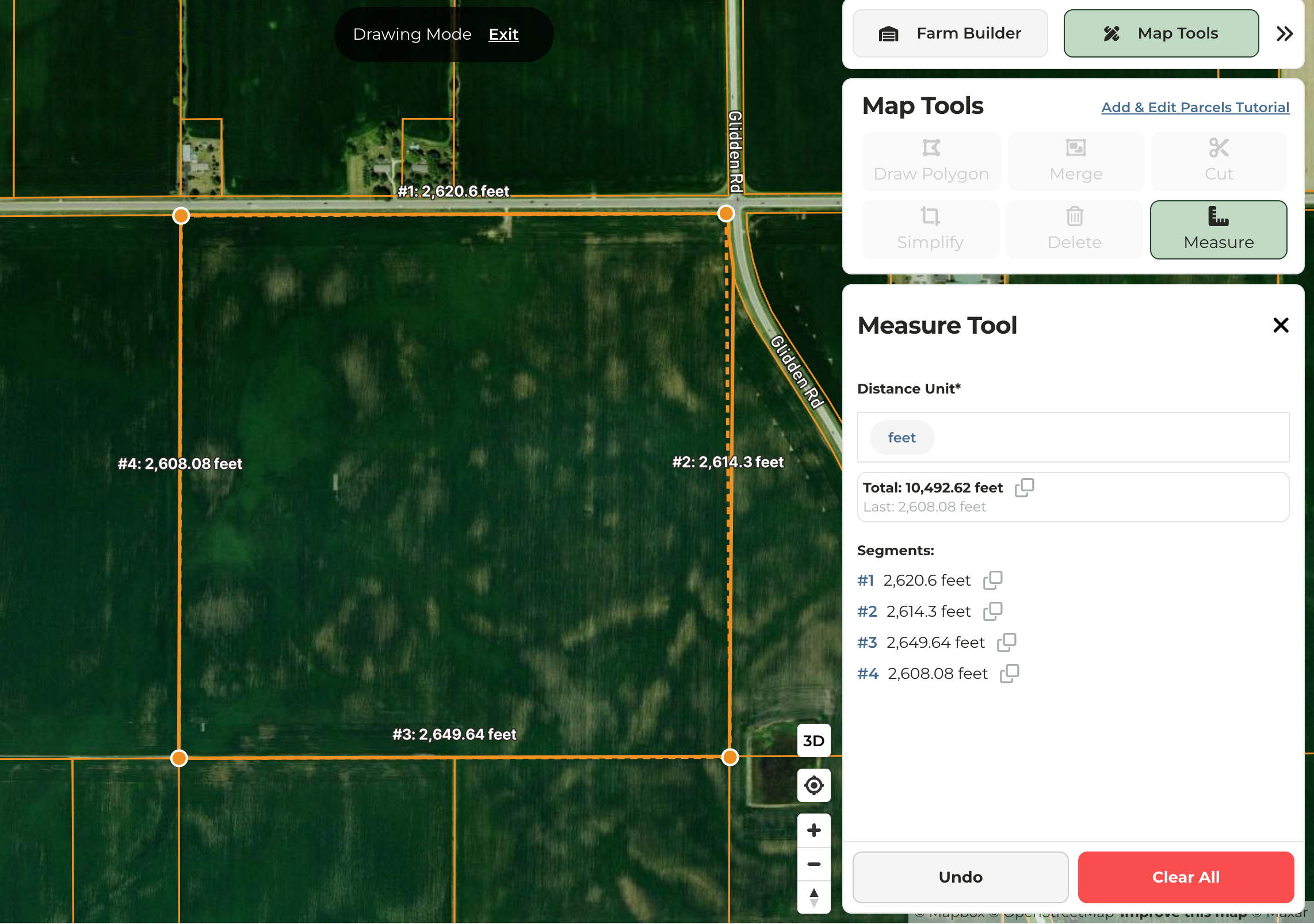
|
**Delete**
* Removes a selected field or parcel.
**Measure**
* Measures the distance between points in feet, yards, miles, meters, or kilometers.
* Multiple points can be dropped and distance will be measured between each point and totaled
* Measurements can be copied and pasted but will not be saved.
