> ## Documentation Index
> Fetch the complete documentation index at: https://docs.camo.ag/llms.txt
> Use this file to discover all available pages before exploring further.
# Creating Custom Map Layers Using County and/or Township Boundaries
***\*Requires Pro Subscription***
***\*Requires Organization Edit or Admin permissions***
* Yes - your features can consist of both county boundaries and townships
### **Terms to Know**
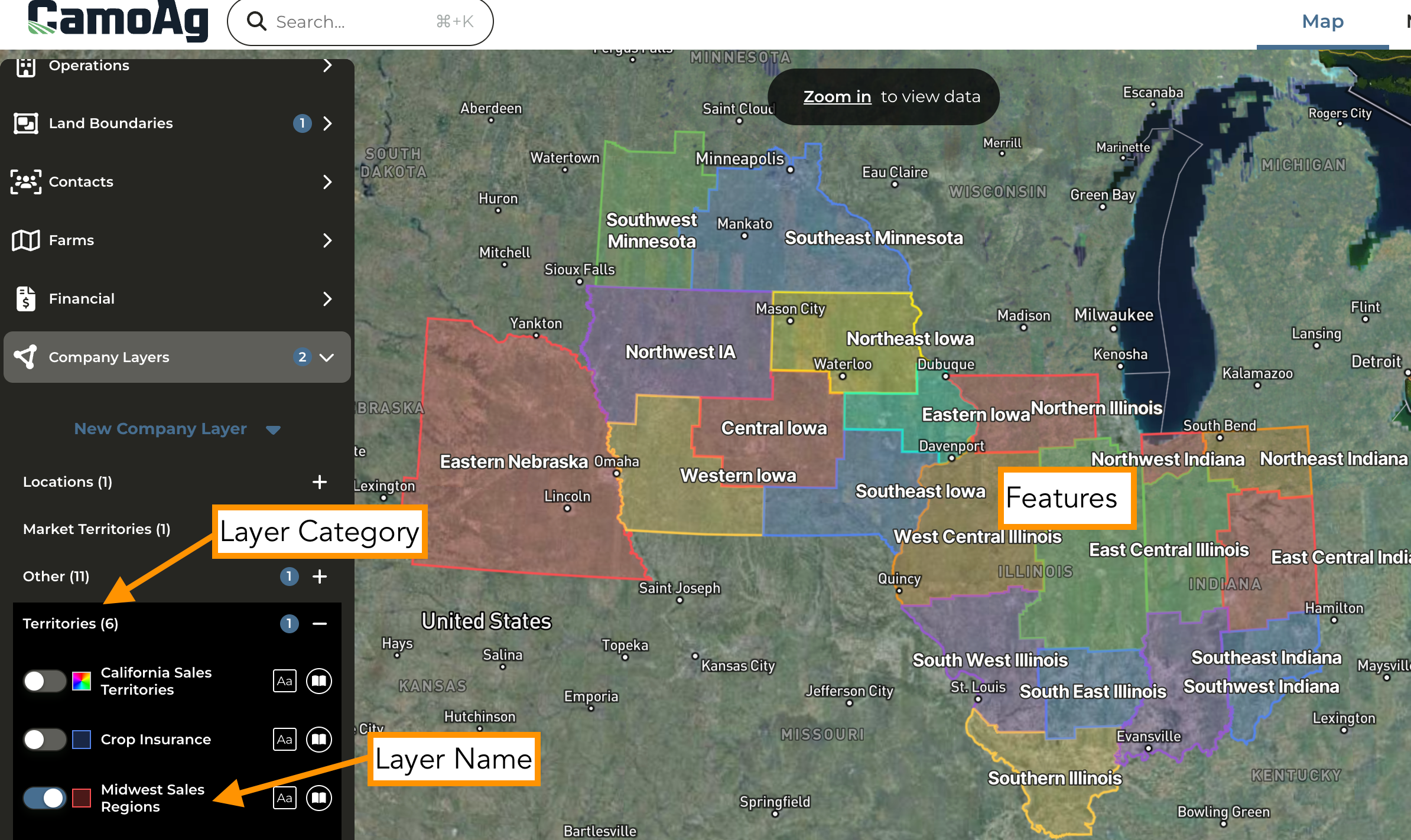
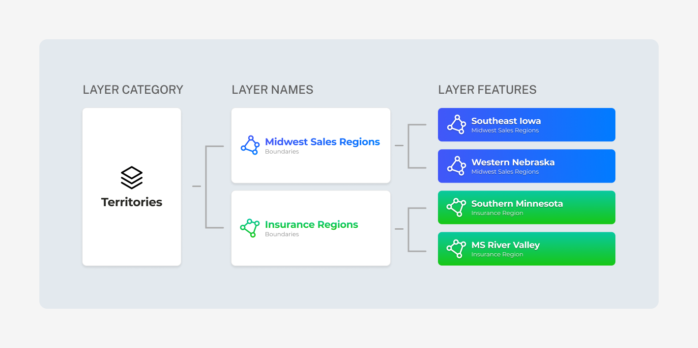
* **Layer Category:** The Layer is the category under which the features will exist. Some layer examples could be: Territories, Weather Events, Water Districts, and Office Locations to name a few.
* **Layer Name:** Assign a more defined name for the map layer. The Layer Name can be toggled on or off on the map.
* **Features:** Layer features is where you actually define the boundaries and further define the feature. When you enable a Layer Name, all Features added to that Layer Name will appear on the map.
#### **Please review the** [**Planning Your Custom Map Layers**](/hc/en-us/articles/34320394518679-Planning-Your-Custom-Map-Layers) **guide before getting started**
Navigate to the Map
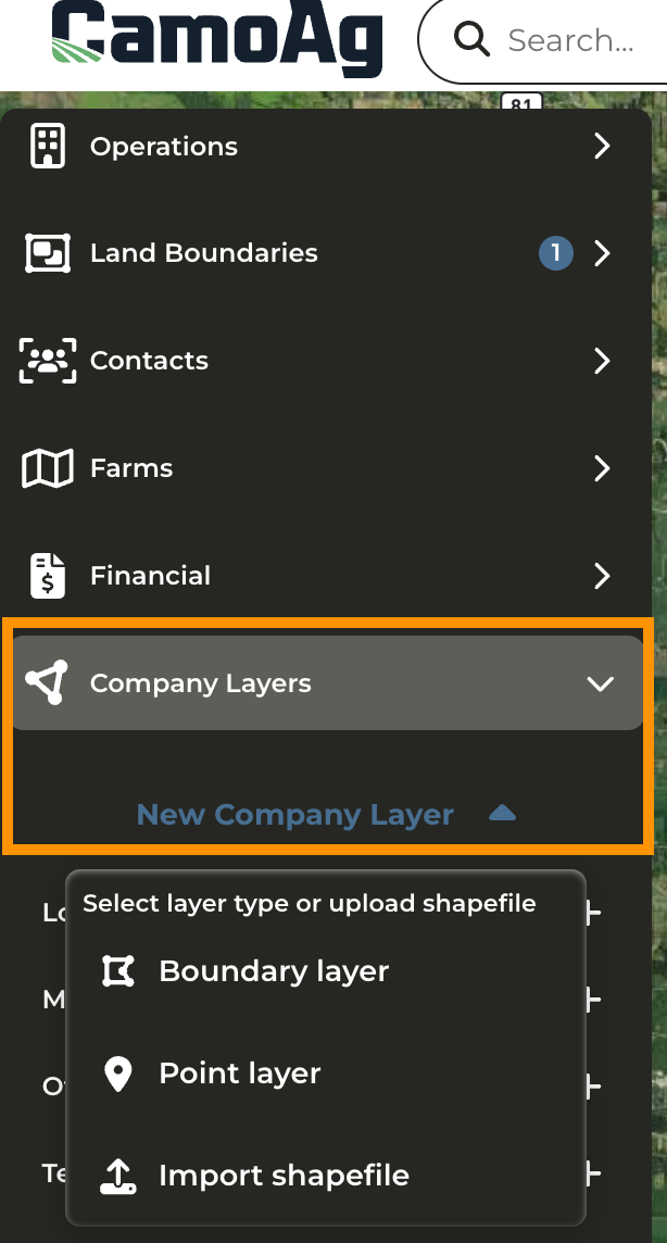
Click **Company Layers > New Company Layer** and select **Boundary Layer**
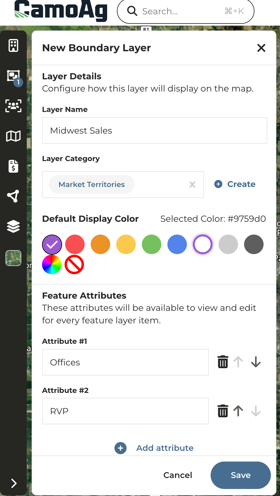
Assign a **Layer Name**
Next, assign a **Layer Category** or **Create a New Category**
Select a display color for the **Layer Name**
Click **Save**
Click **Add feature to layer**
Click **Multi-select** under **Add feature to layer** and select either Counties or Townships from the dropdown
Click on all counties/townships that belong to this feature layer. If your feature consists of both counties and townships, simply select your county information then select townships from the dropdown and continue making your selections.
Once you have selected all the counties and/or townships click **Exit**
Click **Finish selection**
### Once completed, your Layer may look something like this: