> ## Documentation Index
> Fetch the complete documentation index at: https://docs.camo.ag/llms.txt
> Use this file to discover all available pages before exploring further.
# Creating Custom Map Layers: Location Points (Bulk Upload)
**\*Available only to Enterprise Customers**
#### **Completing the Provided Templates**
* Templates can be found at the bottom of this article.
* Customers with this module, we support a Map Layer import via CSV
* Each layer should be uploaded as a separate CSV file. For example, Office Locations would be one layer and one file and livestock feed lots would be a second layer and a second file.
* An item's location can either be a point on the map, such as a well, irrigation pump, office location, etc. or a boundary of an area, such as a lending region, water district, etc.
* The import expects one map layer item per row (see examples below)
* Optional "Properties" fields should be entered and will display in CamoAg as entered. For example branch\_manager or Branch Manager.
* **Files should be saved as CSV and sent to your Customer Success Manager at CamoAg to coordinate uploading**
### **Required Fields**
* **title** (String) - The name of the item\
Example: “Water Well Number 1” or “Springfield Branch Location”
* **layer\_name** (String) - The name of the layer \
Example: ‘California Water Wells’ or ‘Branch Locations’
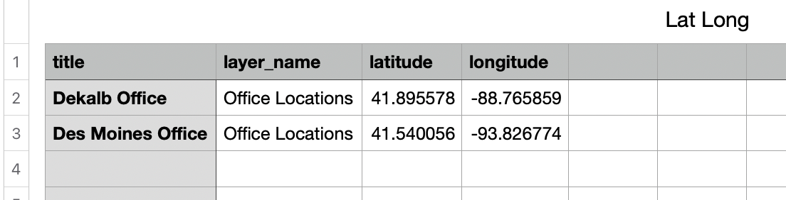
* **Item Location:** Point on the map identified by latitude/longitude coordinates or an address. *Depending which option you choose to locate the point, the column titles should be written out as demonstrated in the below screenshots.*
**Option 1: Latitude/Longitude Coordinates**
* latitude (String) - latitude coordinate
* longitude (String) - longitude coordinate
**Option 2: Address**
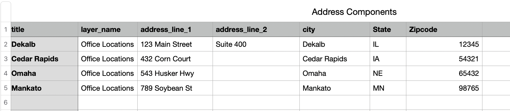
* **address:** An address should be provided as a single address string OR broken out by address components, but not both on the same file
**Example: Address String**

**Example: Address Components**
* address\_line\_1
* address\_line\_2
* city
* state
* zipcode
### ***Optional Fields***
***Reserved optional fields***
* external\_id (String) - Used as an unique identifier for the point or boundary location
Any other fields provided in the csv will be converted to a ‘properties’ field and shown in the platform as seen in the screenshot below. Properties can be edited from the map in CamoAg.
**Sample Optional Fields**
* branch\_region = “Midwest”
* branch\_manager = “John Sample”

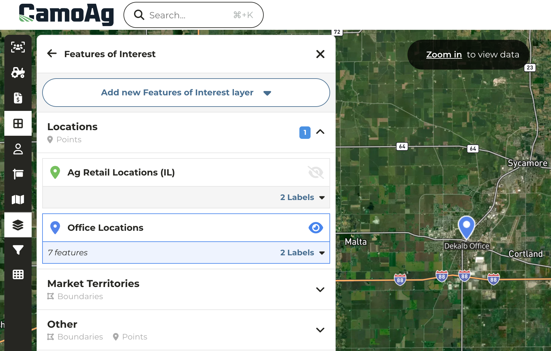
Layer Category = Locations and Layer Name = Office Locations
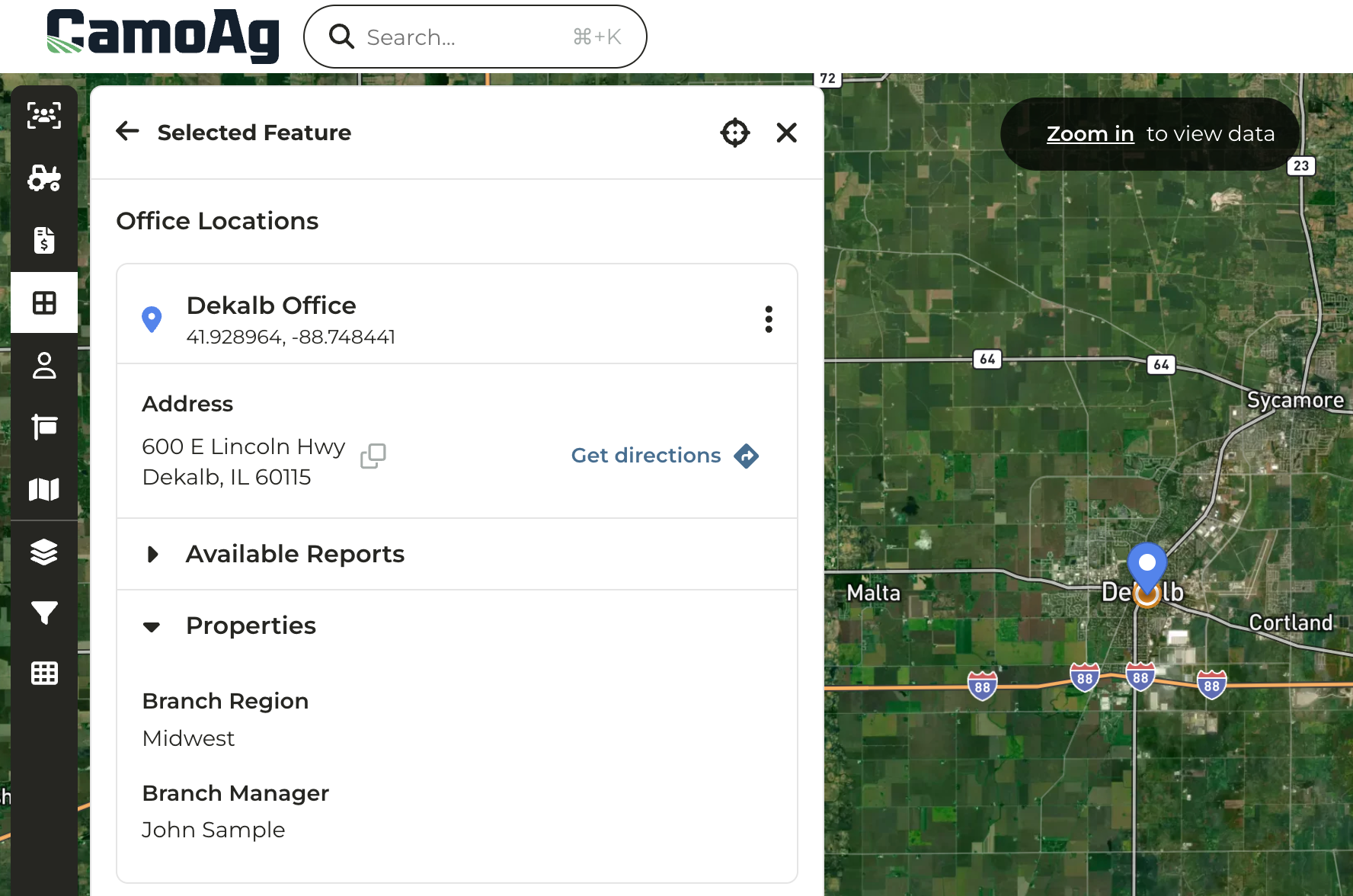
The Title of the Point can include Properties to add more detail
* [Lat.Long.Map\_Layer\_Template.csv](/hc/en-us/article_attachments/36341812962199)
(39 Bytes)
* [Addresses.Map\_Layers\_Template.csv](/hc/en-us/article_attachments/36341820317207)
(73 Bytes)