> ## Documentation Index
> Fetch the complete documentation index at: https://docs.camo.ag/llms.txt
> Use this file to discover all available pages before exploring further.
# View Historical Imagery for a Property
> Google Earth can be accessed from any map in the platform. If you want to upload a KMZ file to Google earth to view the parcel boundaries, you will first need to add the property to your account.
### Accessing From the Map
Navigate to the **Map** and locate the property
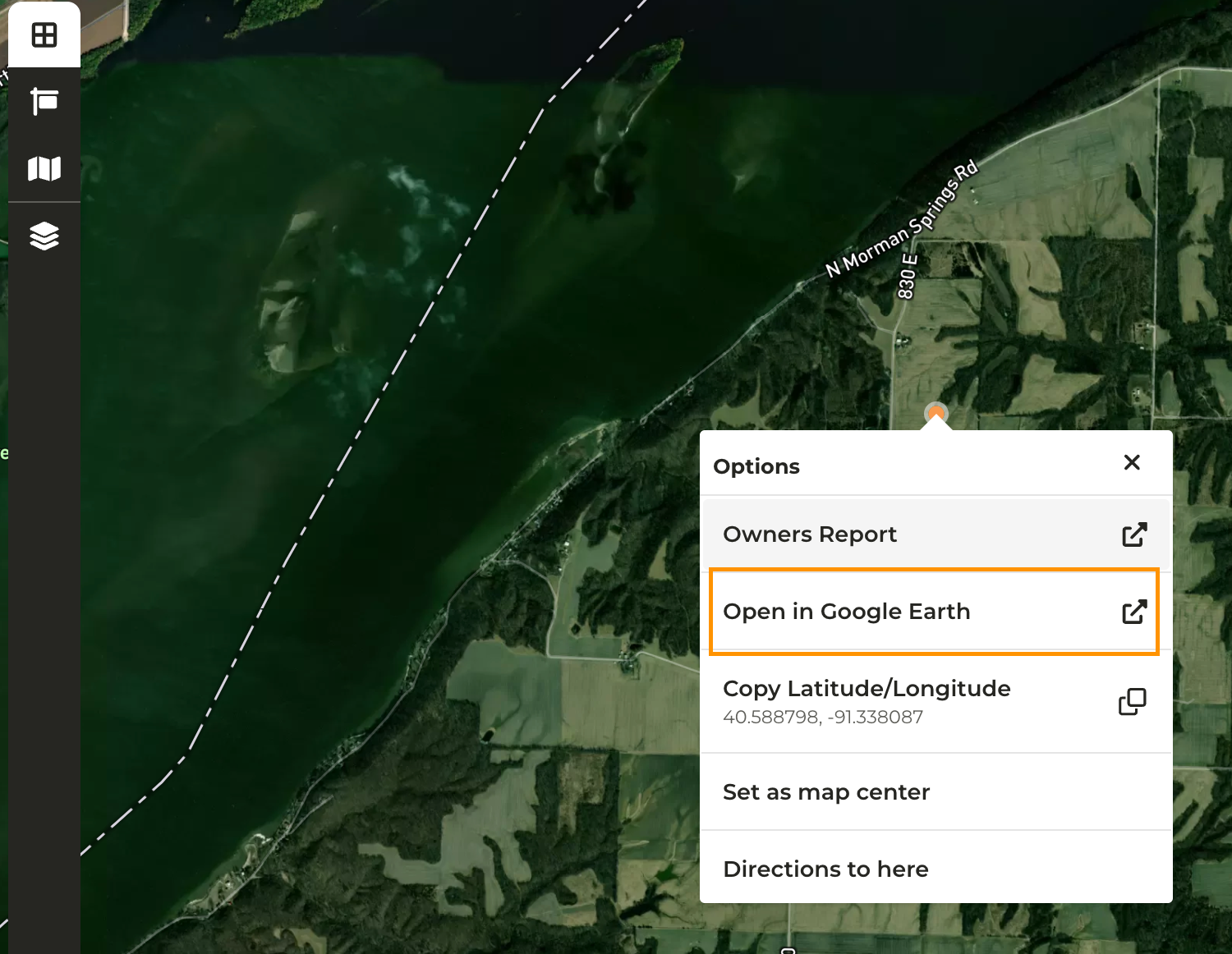
Right-click on the map and click ****Open in Google Earth****
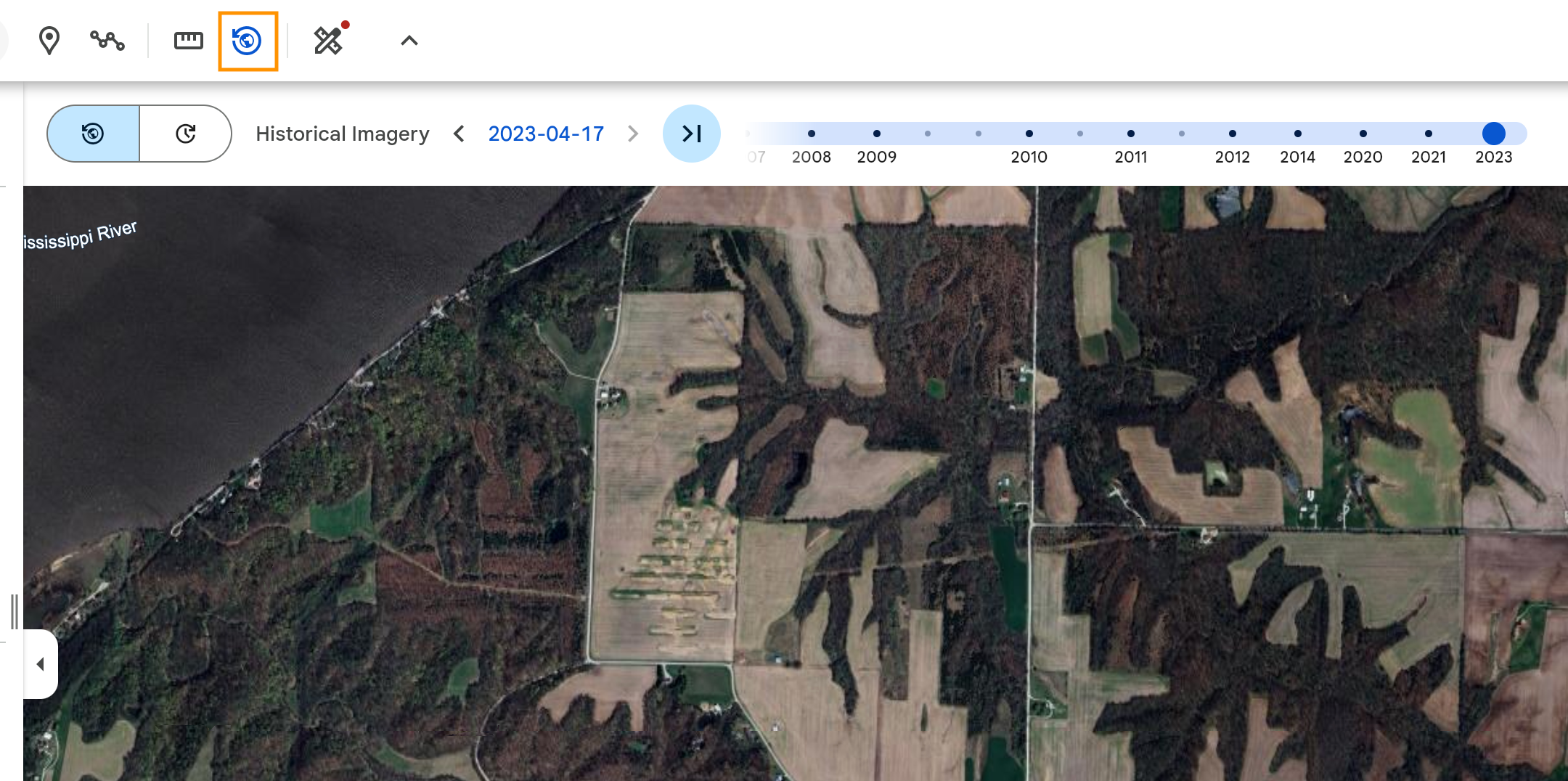
Google Earth will open in a new tab
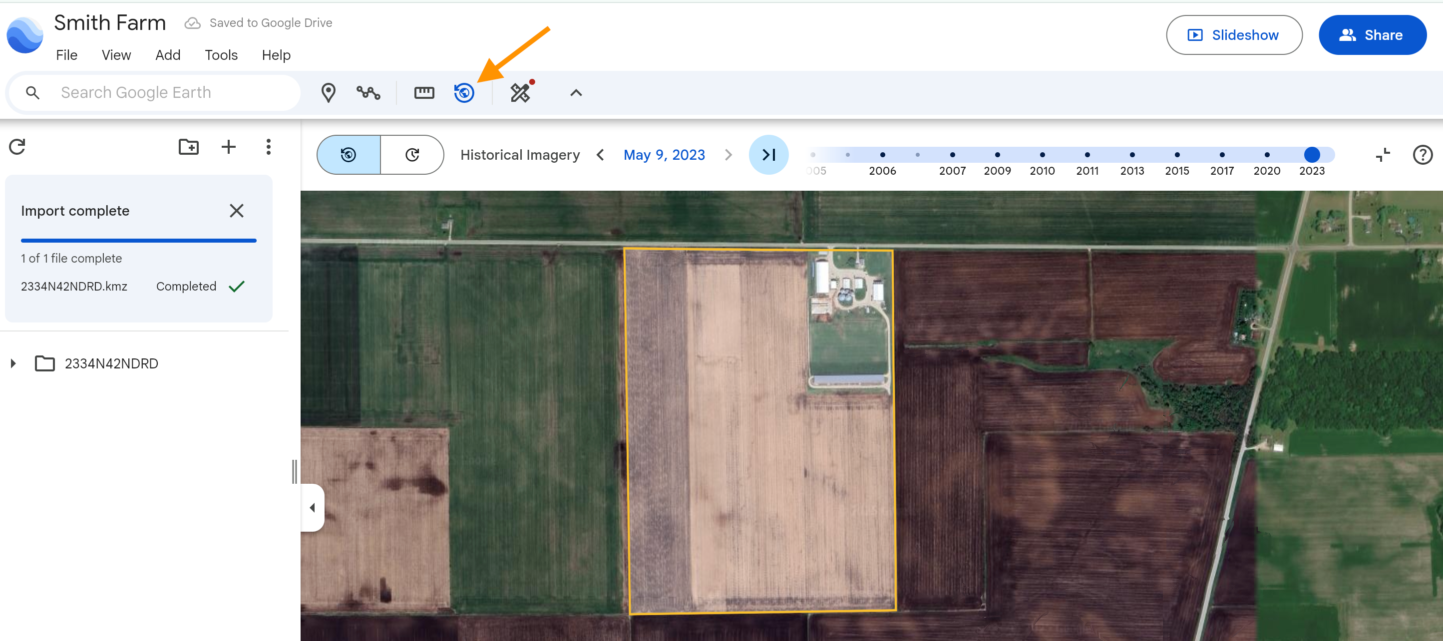
Click on the **Historical Imagery** icon
### Downloading a KMZ File for Google Earth
Add the property to your account
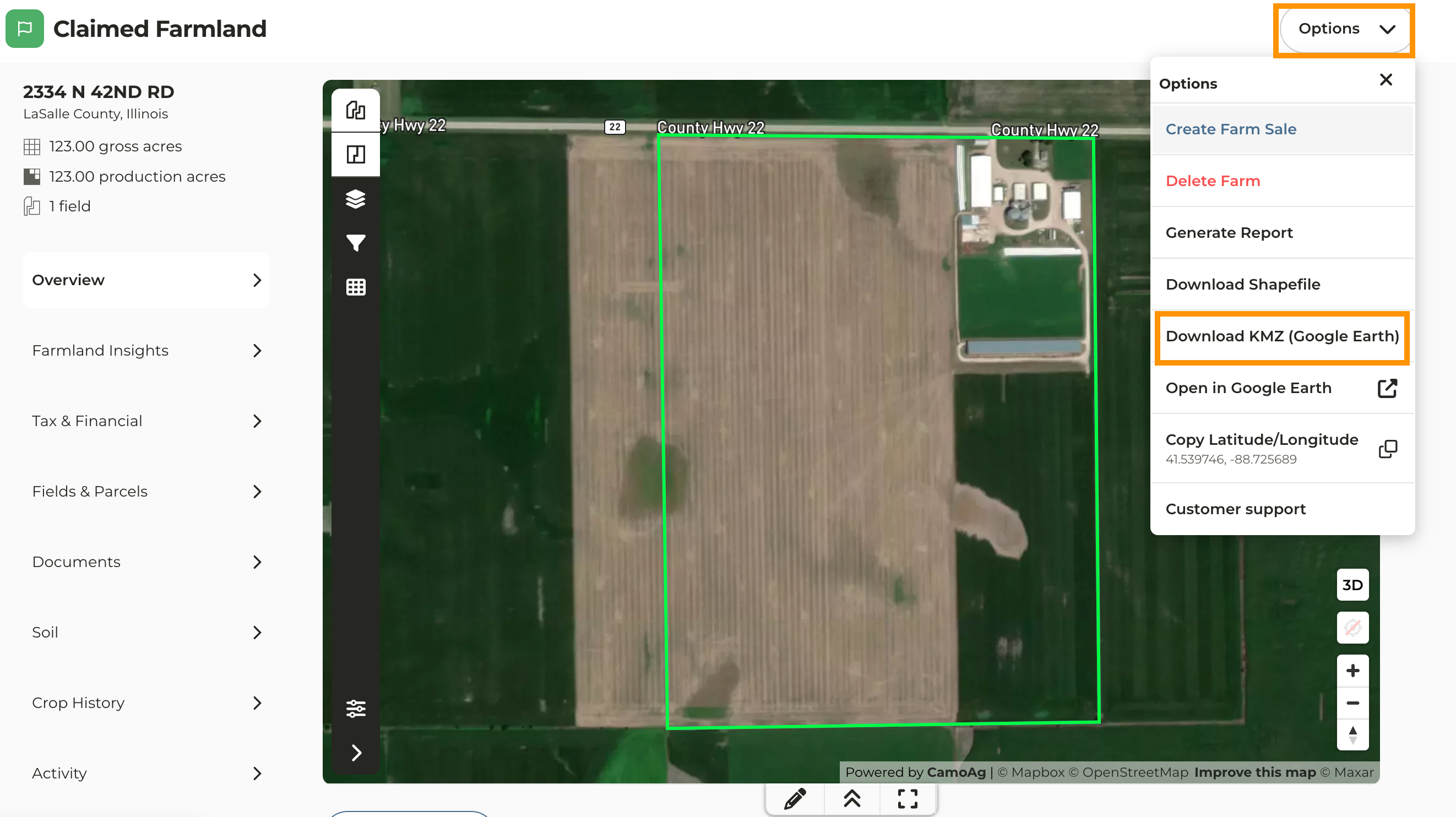
From the property overview page click **Options > Download KMZ (Google Earth)** to download the shape file to your device
From the same menu click ****Open Google Earth****
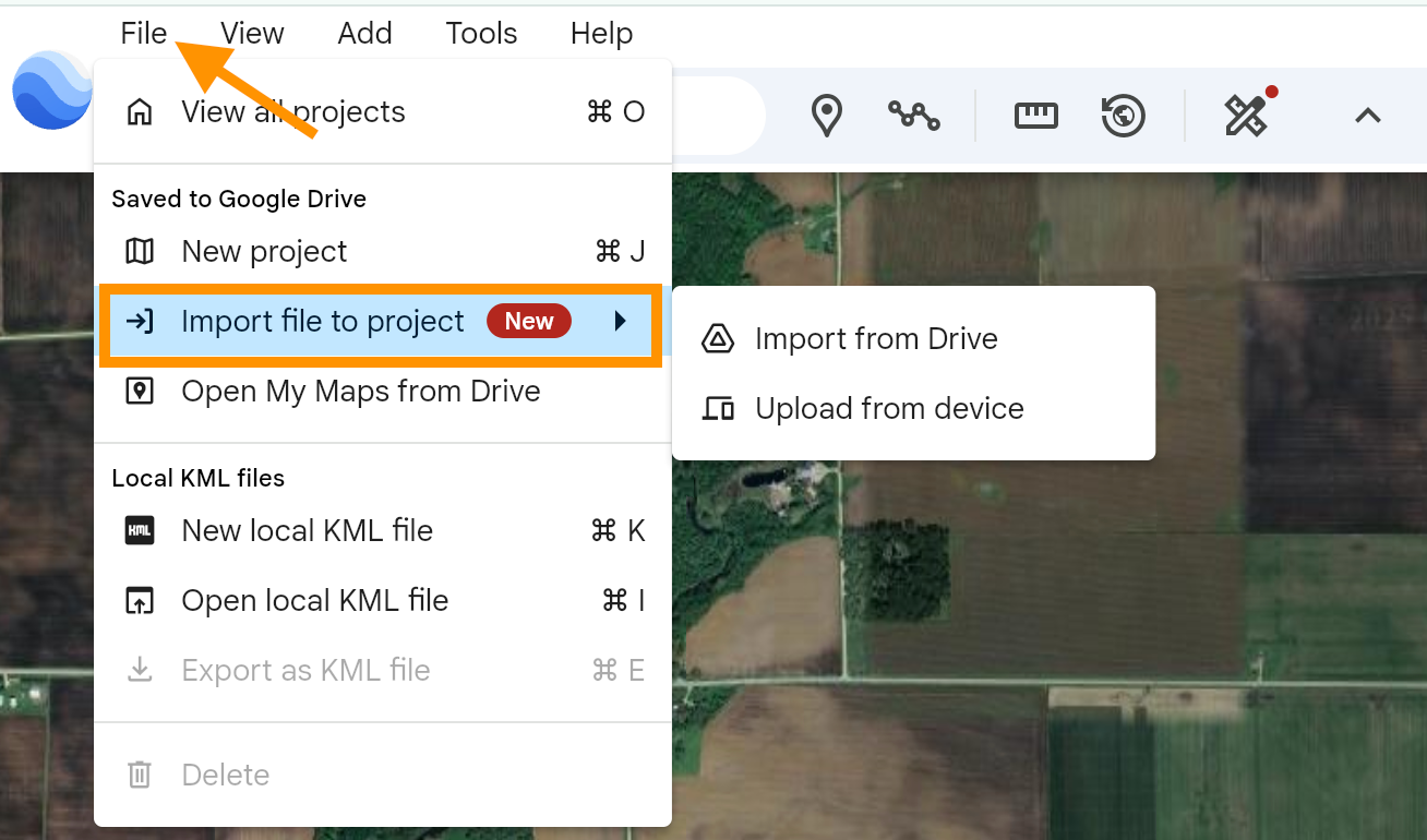
In Google Earth click **File > Import File to Project** and select the shape file you just downloaded
Enable the Historical Imagery and begin exploring