> ## Documentation Index
> Fetch the complete documentation index at: https://docs.camo.ag/llms.txt
> Use this file to discover all available pages before exploring further.
# Using the Cut Tool
* [**Use the Draw Polygon Tool**](/hc/en-us/articles/23973220859287-Using-the-Draw-Polygon-Tool) **if you want to:**
* Measure a precise area using feet and acres
* Draw a field by hand
* Isolate non-productive acres from a field that are surrounded by tillable acres
* Isolate non-productive acres that span across more than one field or parcel
* **Use the Cut Tool if you want to:**
* Quickly divide a single field into multiple fields
* Subdivide a parcel
* Isolate non-productive acres that are along the border of a field
* Yes. If your original shape is 80 acres and you use either the Draw Polygon or Cut tool, to create a new 20 acre field, the original shape will now show as 60 acres.
## **Using the Cut Tool**
#### **Start Here if Editing an Existing Property in Your Account**
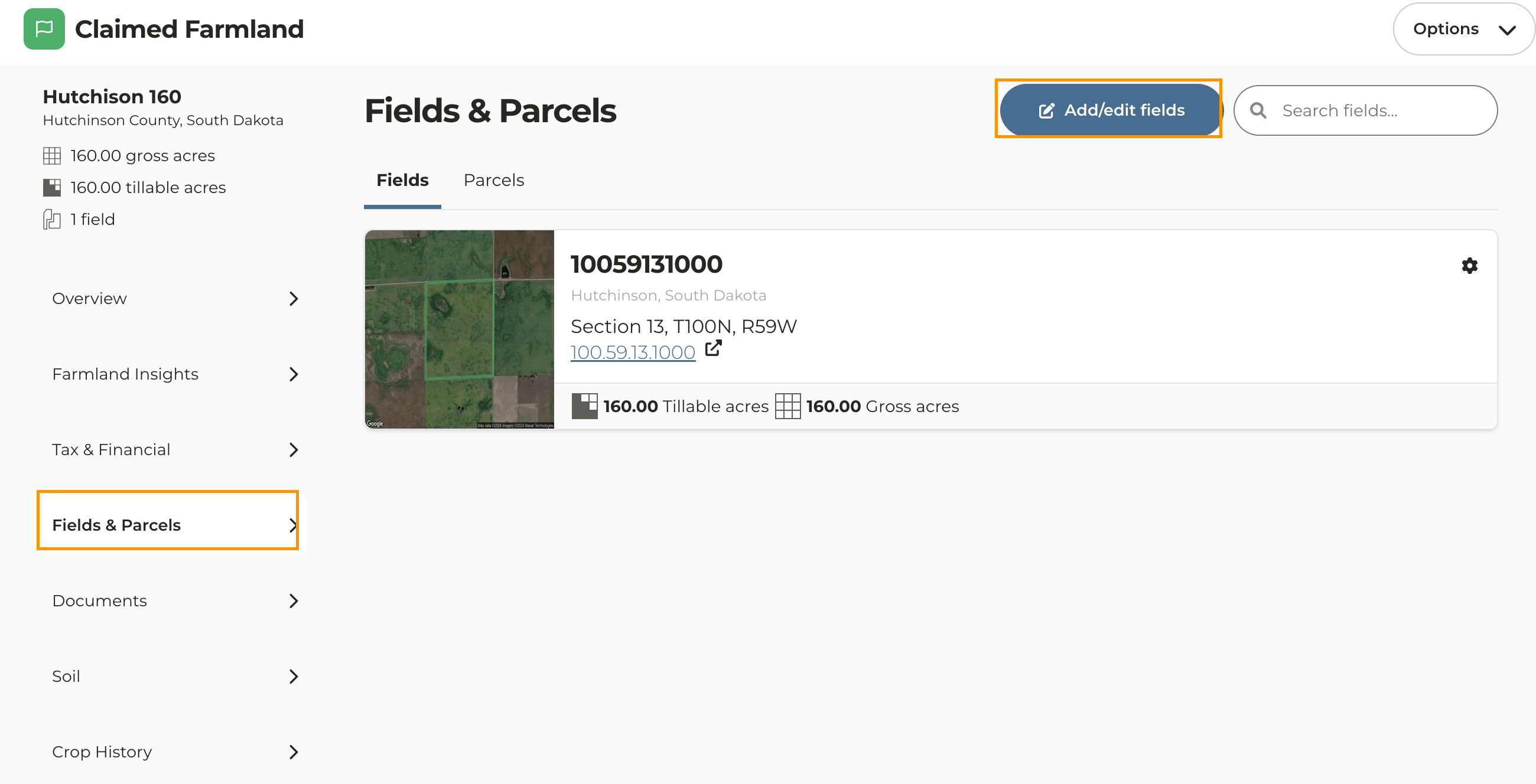
Navigate to the property you want to edit
Click on **Fields & Parcels** then click **Add/Edit Fields**
#### **Start Here if Editing a Property Currently Being Added to Your Account**
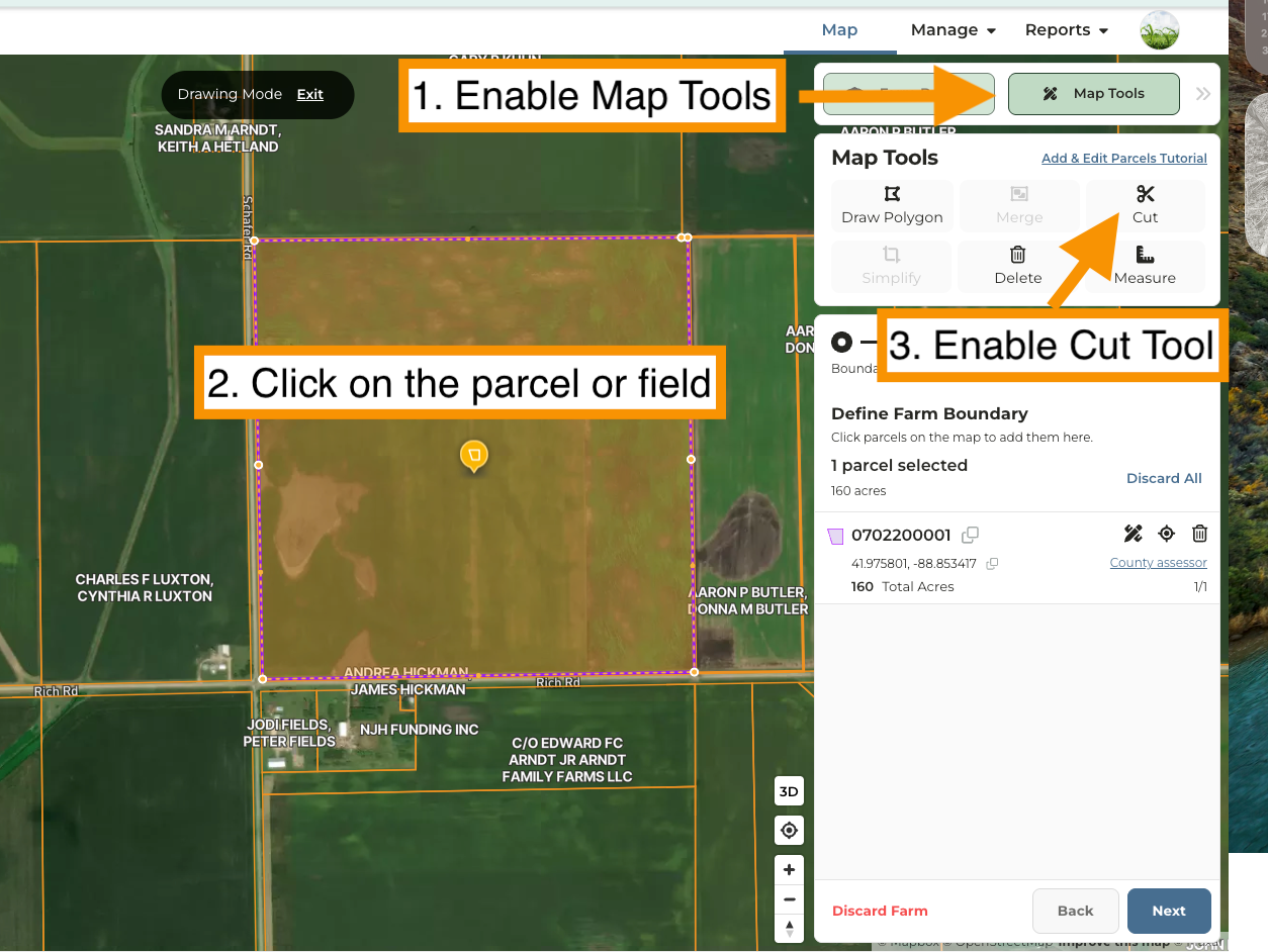
Enable **Map Tools**
Click on the field or parcel
Click **Cut** to enable the cut tool
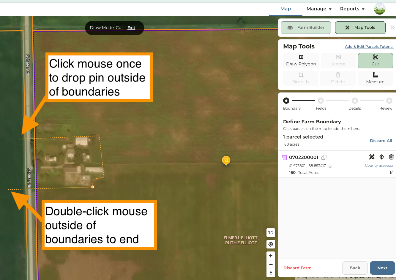
On the map near the area you want to cut, drop a point outside of the boundaries with one mouse-click
Move the cursor into the field border and begin dropping points by clicking your mouse to outline the area
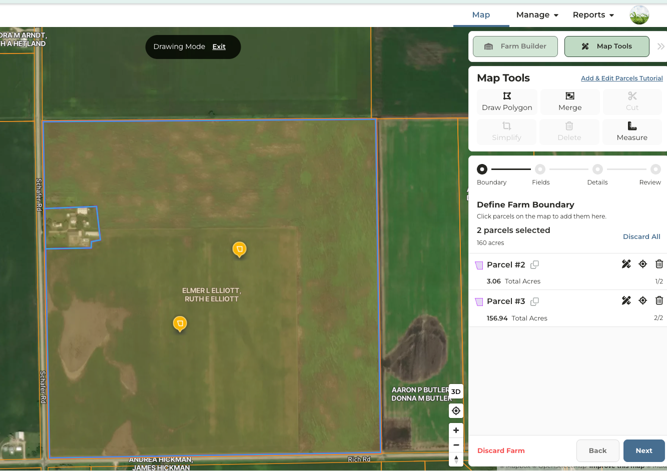
A second parcel or field will now appear.
Click **Next** to continue through the Farm Builder workflow