> ## Documentation Index
> Fetch the complete documentation index at: https://docs.camo.ag/llms.txt
> Use this file to discover all available pages before exploring further.
# Operators Report
> Operator data on this report is provided by CamoAg
## **Operator Filters**
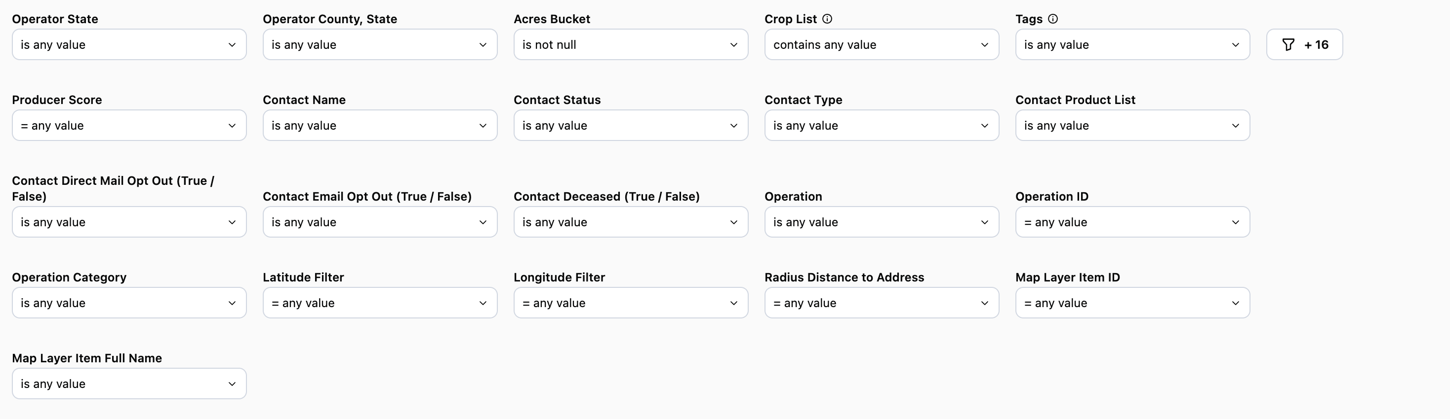
**Operator State & County:** Use these filters to hone in on one or more counties you want to focus on
**Acres Bucket:** Filter by a range of acres that an operator may fall into. For example, 3k-5k acres, 10k and above, etc.
**Crop List:** Filter defaults to "Contains" which is what should be used when filtering by crops on this report
**Tags:** [**Operation Tags Definitions**](/hc/en-us/articles/38622849839383-Operation-Tags-Definitions) - Coming soon!
**Contact Name:** Name of the contact you created in CamoAg or as it appears in your organization’s CRM if integrated with CamoAg
**Contact Status:** Filter by statuses such as lead, contact, account, or prospect. The statuses here may differ if your organization’s CRM is integrated with CamoAg
**Contact Type:** Filter by types such as individuals or business types
**Contact Product List:** Requires CRM integration. Filter your report to include or exclude organization contacts who have specific products
**Use Case:** You want to generate a list of contacts who do not currently purchase Crop Insurance from your organization, but do have an Operating Line of Credit. Use "does not contain" and select Crop Insurance then add “does contain” Operating Line of Credit.
*Note: If you select "is not equal to" the results may still include contacts who use crop insurance if they also purchase other products from your organization.*
**Contact Direct Mail Opt Out (True/False):** Requires CRM integration
**Contact Email Opt Out (True/False):** Requires CRM integration
**Contact Deceased (True/False):** Requires CRM integration
**Operation:** Will list the primary name associated with the Operation.
**Operation ID (Formerly “Network ID”):** The Operation ID is unique to CamoAg and is used to create operations by grouping parties who either reside at the same address or who have been connected together as a single entity
**Use Case:** Include the Operation ID on mailers as a reference code for people to use when they reach out. You can then search for the customer/prospect using the reference code within a report to quickly locate parcels owned by this individual or entity.
\*\*Operation Category (Formerly “Primary Addressee Type”):\*\*The type of address associated with the operation name. Defaults to **Operators** on this report.
**Latitude & Longitude:** These can be manually entered, but populate when you access the report by right-clicking on the map.
**Distance to Address (in miles):** This sets the radius around the parcel or address for your search and pulls in any owner who has land within that radius. Populates by default to 10 miles when you access the report by right-clicking on the map.
**Map Layer Item ID:** This filter is populated when the report is accessed via a [Features of Interest](/hc/en-us/articles/26601919891735-Generating-a-Report-from-a-Custom-Features-of-Interest-Layers) layer on the map. The report will filter to show only data within the boundaries of that FOI layer.
### **Data Tables**
**Operations, sorted by size**
* Rolls up all parcels operated by an operation
* Estimated Acres Bucket: Displays the estimated range of acres believed to be operated
* Contact or CRM information will display in the last six columns
