> ## Documentation Index
> Fetch the complete documentation index at: https://docs.camo.ag/llms.txt
> Use this file to discover all available pages before exploring further.
# Using the Draw Polygon Tool
* Yes - if you are in the process adding a property to your account begin at Step 3.
* **Use the Draw Polygon Tool if you want to:**
* Measure a precise area using feet or miles and acres, square miles, or square feet
* Draw a field or parcel by hand. Note if you draw a parcel manually the parcel ID and convenience link to assessor data will not be available.
* Isolate non-productive acres from a field that are surrounded by tillable acres
* Isolate non-productive acres that span across more than one field or parcel
* [**Use the Cut Tool**](/hc/en-us/articles/26589948400151-Using-the-Cut-Tool) **if you want to:**
* Quickly divide a single field into multiple fields
* Subdivide a parcel
* Isolate non-productive acres that are along the border of a field
* Yes. If your original shape is 80 acres and you use either the Draw Polygon or Cut tool, to create a new 20 acre field, the original shape will now show as 60 acres.
## **Using the Draw Polygon Tool**
Navigate to the map and enable the Farm Builder > Map Tools
Click **Draw Polygon**
At the bottom middle of your screen you will see a measuring tool with **feet** and **acres.** If you would like to change the measurements click on the bar. Feet can be switched to miles and acres can be switched to square miles or square feet
Locate where you want to start drawing the polygon and drop a point on the map with a single-click on your mouse
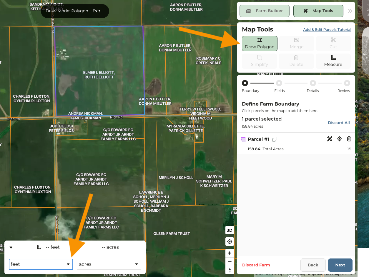
Moving in either a clockwise or counter-clockwise direction, begin to drop points with a single-click using your mouse.
Double-click on the mouse to end the shape
Click **Next**
Continue through the farm builder workflow or **Save Farm.** Note if you save a farm that consists of only a parcel the farm, you will not be able to generate soil maps, crop history, or denote acres types as these are all powered by having a field.