> ## Documentation Index
> Fetch the complete documentation index at: https://docs.camo.ag/llms.txt
> Use this file to discover all available pages before exploring further.
# Getting Started with the Deed Mapper
> Updated 1 year ago
*The CamoAg Deed Mapper allows users to create farm boundaries from legal survey descriptions. This provides the ability to have more accurate boundaries of farms that precisely match the legal boundaries. Users can enter starting points, select the point of beginning, enter calls, as well as exceptions and curves.*
#### ***The Getting Started Guide is intended as the starting point for all other guides found within the Deed Mapper section.***
### Getting Started
First you will want to create a list of calls from your legal description. The legal description used in this example is as follows:
*"Those parts of the Northwest fractional quarter and the Southwest fractional quarter of **Section 11, Township 31 North Range 11 East** of the third principal meridian in **Kankakee County**, **Illinois**, bounded and described as follows: **commencing at the Northwest corner** **of said northwest fractional quarter**, and running;*
*Thence **North 88 degrees 58 minutes 00 seconds East**, along the North line of said Northwest fractional quarter, **1319.85 feet** to the Northeast corner of said Northwest fractional quarter;*
*Thence **South 01 degrees 31 minutes 07 seconds East**, along the East line of the last said Northwest fractional quarter, **1791.16 feet** to the **point of beginning**;*
*Thence **South 88 degrees 58 minutes 00 seconds West**, parallel with said North line, **1020.20 feet** to the Southeast corner of parcel of land conveyed by warranty deed No. 200117930 recorded September 11, 2001;*
*Thence **South 86 degrees 38 minutes 54 seconds West**, along the South line of said conveyance, **213.83 feet** to the East line of the Wais-ke-shaw reservation in said township and range, said East line being also the West line of said Northwest fractional quarter;*
*Thence **South 01 degrees 39 minutes 45 seconds East**, along said East line, **846.37 feet**;*
*Thence **South 01 degree 24 minutes 02 seconds East**, along said East line here being also the West line of the Southwest fractional quarter of said Section 11, **1133.95 feet** to the center of Illinois Route 102;*
*Thence **South 54 degrees 17 minutes 40 seconds East**, along said center, **454.47 feet**;*
*Thence **South 56 degrees 46 minutes 57 seconds East** along said center **853.00 feet**;*
*Thence **North 01 degrees 07 minutes 38 seconds West** along the West line of a survey as said West line has been occupied, made by W\.H. Mathewson, May 28, 1862, **1851.27 feet**;*
\*Thence **South 89 degrees, 31 minutes 30 seconds East 157.71** to the Southeast corner of said Northwest fractional quarter and;\**Thence **North 01 degrees 31 minutes 07 seconds** **West** along said East line of the Northwest fractional quarter **893.84 feet** to the point of beginning."*
You will need to go through each line of the legal description to understand what you are reading: where is your starting point, where is your place of beginning, are there exceptions, are there multiple keeps?
***With the example legal description used in this guide, the list of calls created are as follows:***
31N 11E
N88°58'00"E 1319.16ft
S1°31'7"E 1791.16ft
S88°58'00"W 1020.2ft
S86°38'54"W 213.83ft
S1°39'45"E 846.37ft
S1°24'2"E 1133.95ft
S54°17'40"E 454.47ft
S56°46'57"E 853ft
N1°7'38"W 1851.27ft
S89°31'30"E 157.71ft
N1°31'7"W 893.84ft
### Navigating to the Deed Mapper
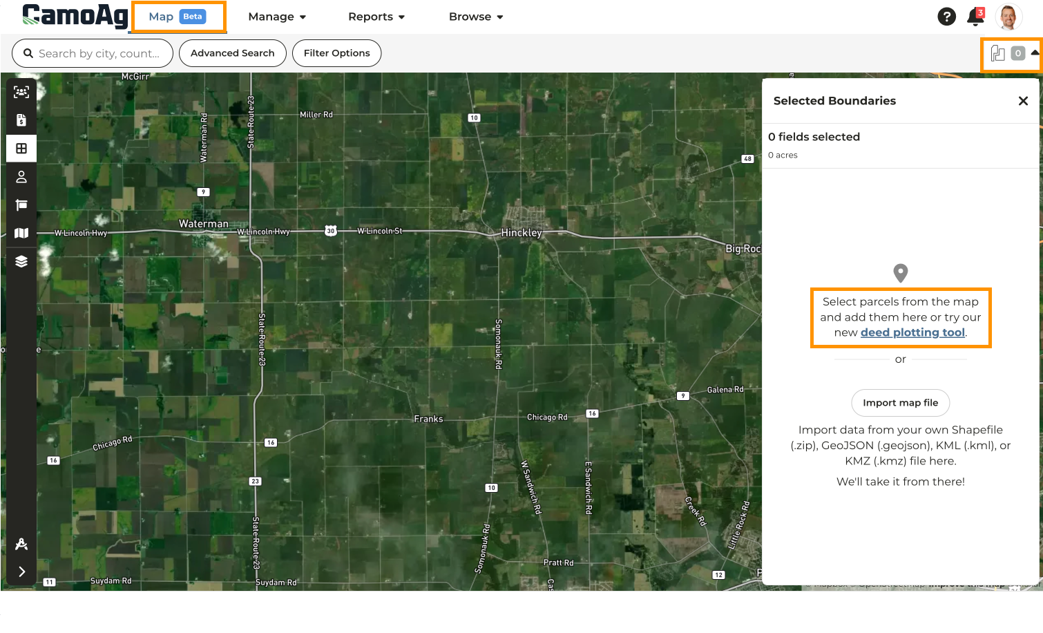
From the Dashboard click into the **Map**
Once on the **Map**, click on the number in the upper right corner, then select the **Deed Plotting Tool** hyperlink in the side panel
### **Finding the Starting Point**
*What is the Starting Point? The starting point is the point at which the calls in the legal land description start, but it may not be where the parcel itself starts.*
Refer to the **Legal Land Description** for the property with which you are working and enter the location in the search bar located above the map in CamoAg. For our example, we will be using Kankakee County, IL
Click **Filter Options** to further your search by **Township-Range** and **Section**
The STR will be highlighted in yellow, to free up space on your screen click the X to collapse the filter options
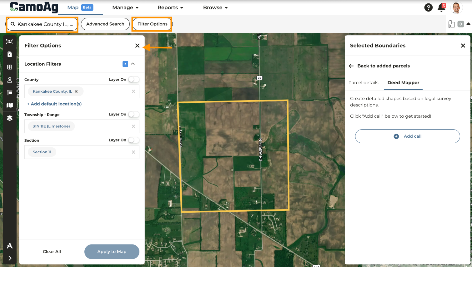
Click **Add Call**
Select either ******Point on Map or Latitude Longitude******
* **Lat/Long:** If using Latitude/Longitude, select that option from the dropdown and enter in the coordinates
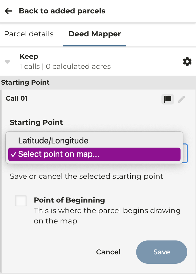
* **Point on Map:** This option is best used with the Section,Township, Range search. Click on the map to place your starting point. In the example used in this guide, we need to look at the paragraph *"Those parts of the Northwest fractional quarter and the Southwest fractional quarter of **Section 11, Township 31 North Range 11 East** of the third principal meridian in **Kankakee County**, **Illinois**, bounded and described as follows: **commencing at the Northwest corner** **of said northwest fractional quarter**, and running;* Here we will get the Section, Township and Range as well as the starting point which is in the Northwest corner of section 11, Township 31 North, Range 11 East.
### **Set the Point of Beginning**
***What is the Point of Beginning? This is the point at which the parcel actually starts being drawn.***
If your starting point is the point of beginning, select the checkbox for **Point of Beginning** and click **Save.** If the starting point if different from the **Point of Beginning** simply click **Save.**
**Note: The example we are using has a starting point that is different from the point of beginning.**
### Adding Calls
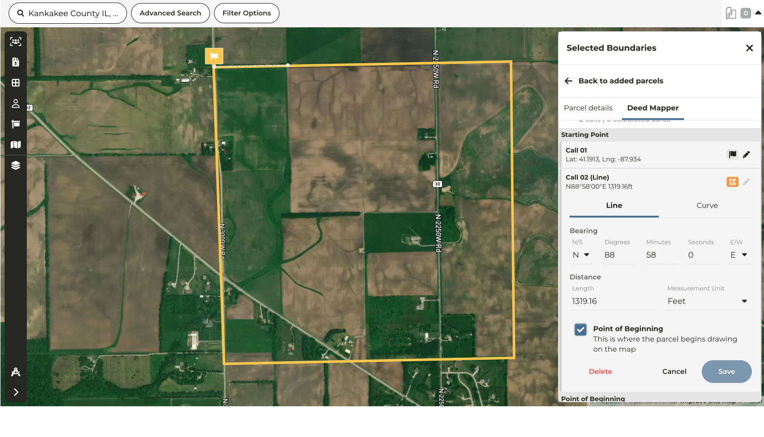
To enter a call click **Add Call**
Click on the **Line or Curve** tab depending on the type of call you are making.
**Note: For our example we will be using a line**
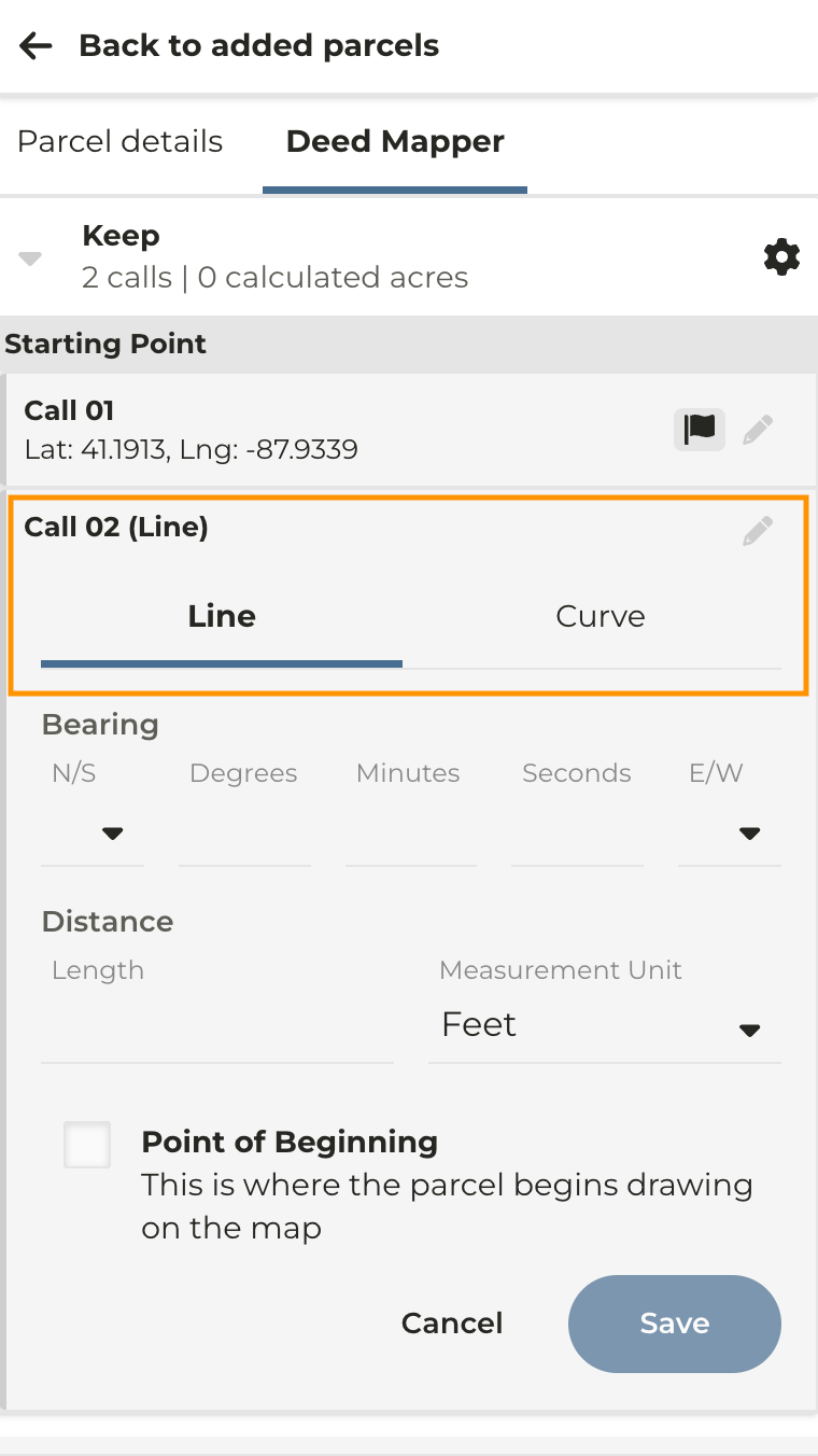
Continue to add calls until you reach the place of beginning
Once you reach the place of beginning, click the box next to **Place of Beginning** then click ******Save******
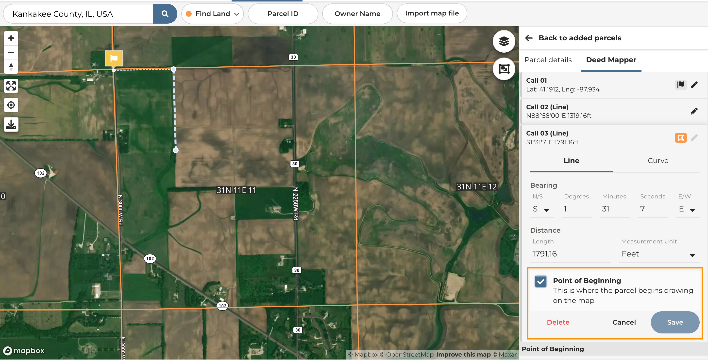
You will notice the point of beginning for the parcel is noted with an orange marker in your list of calls
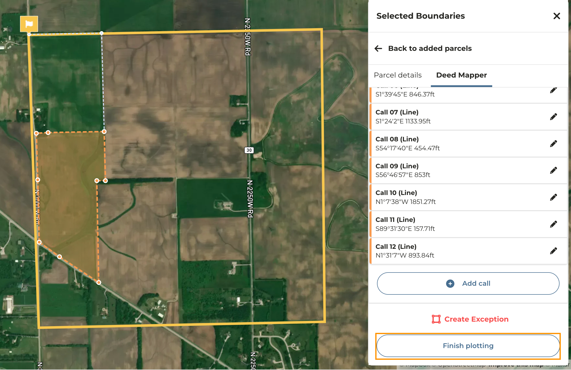
Continue to add calls until you have completed the outline of the parcel
Once you have added all of your calls click **Finish Plotting**
A field will automatically be created from the parcel plotted
### Multiple Parcels or Keeps in Legal Description
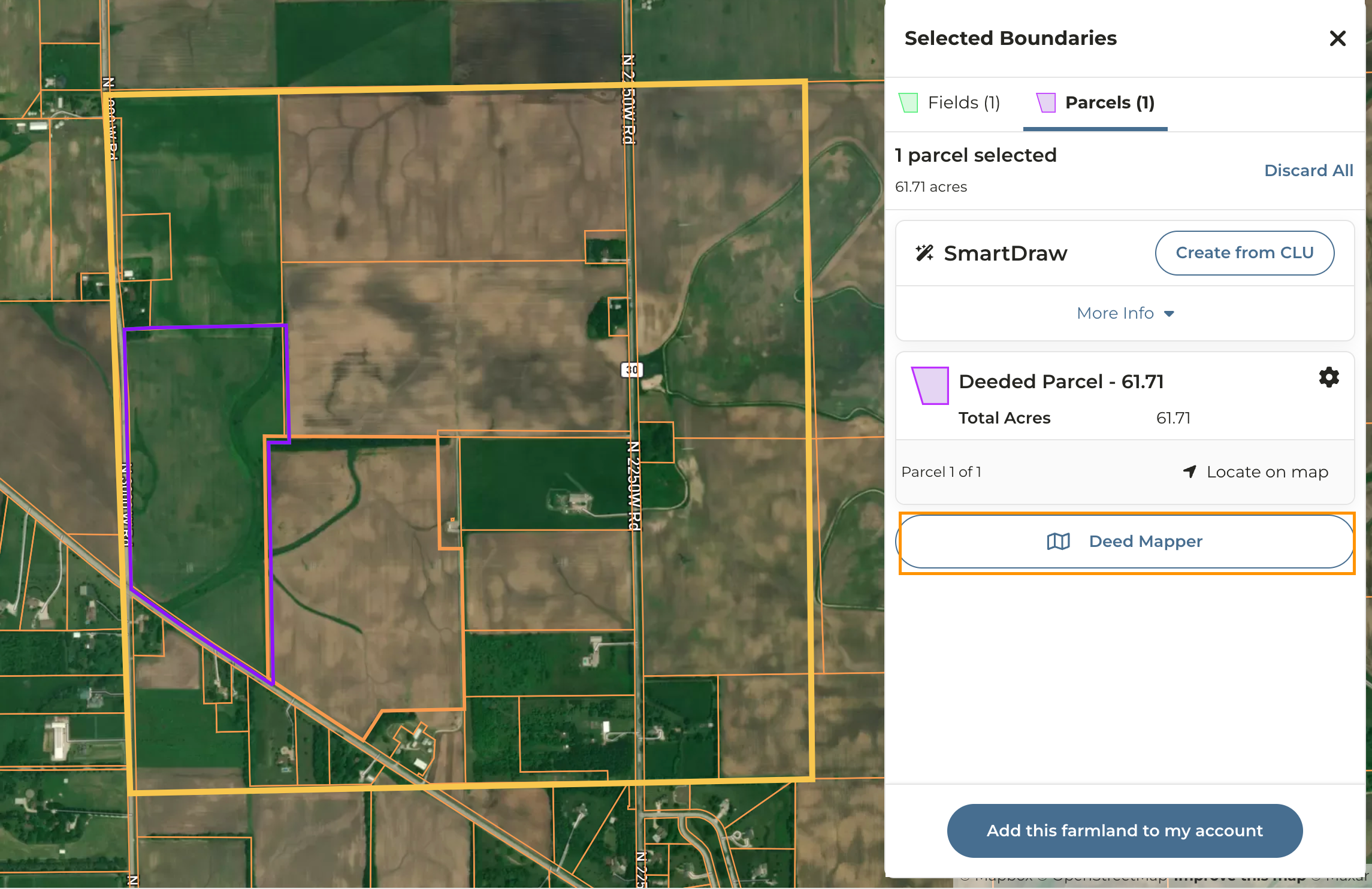
If you have multiple parcels or keeps that make up a legal description, add the first parcel using the deed mapper, then select the deed mapper again to add the second parcel.
**Additional guides can be found below:**
[Editing Calls](/hc/en-us/articles/21914826066711-Editing-Calls)
[Entering an Azimuth](/hc/en-us/articles/21885561969687-Entering-an-Azimuth)